MyTopo
Fountain Grove Missouri US Topo Map
Couldn't load pickup availability
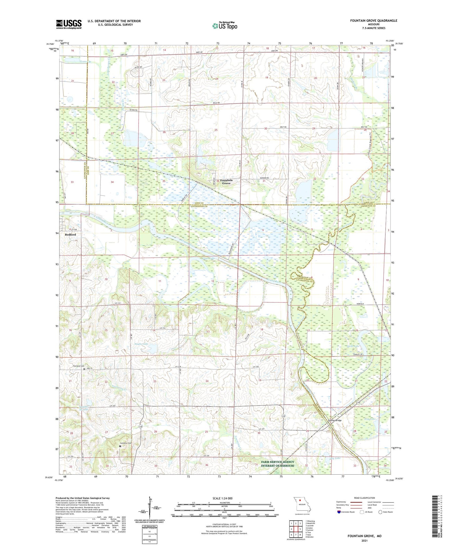
2021 topographic map quadrangle Fountain Grove in the state of Missouri. Scale: 1:24000. Based on the newly updated USGS 7.5' US Topo map series, this map is in the following counties: Livingston, Linn, Chariton. The map contains contour data, water features, and other items you are used to seeing on USGS maps, but also has updated roads and other features. This is the next generation of topographic maps. Printed on high-quality waterproof paper with UV fade-resistant inks.
Quads adjacent to this one:
West: Avalon
Northwest: Wheeling
North: Meadville
Northeast: Laclede
East: Sumner
Southeast: Mendon
South: Hale
Southwest: Tina
This map covers the same area as the classic USGS quad with code o39093f3.
Contains the following named places: Bedford, Bedford Post Office, Big Lake, Cameron Cemetery, Center Branch, Center School, Dry Lake, Eagle Lake, Elk Grove School, Fairland Cemetery, Foster Lake Dam, Fountain Grove, Fountain Grove Conservation Area, Fountain Grove Lake, Fountain Grove Lake Dam, Grace Church, Hanson Lake Dam, Hazel Creek, Hazel Green School, Hickory Branch, Hog Lake, Hughs Lake, Jacks Lake, Leaton School, Little Parson Creek, Locust Creek, Locust School, Missouri Valley Planning Region, Morgan School, Number 59 Lake, Parson Creek, Pleasant View School, Stanley Lake, Sumner Bridge, Sumner Ferry, Township of Grand River, Trinity Church, Union School