MyTopo
Miami Station Missouri US Topo Map
Couldn't load pickup availability
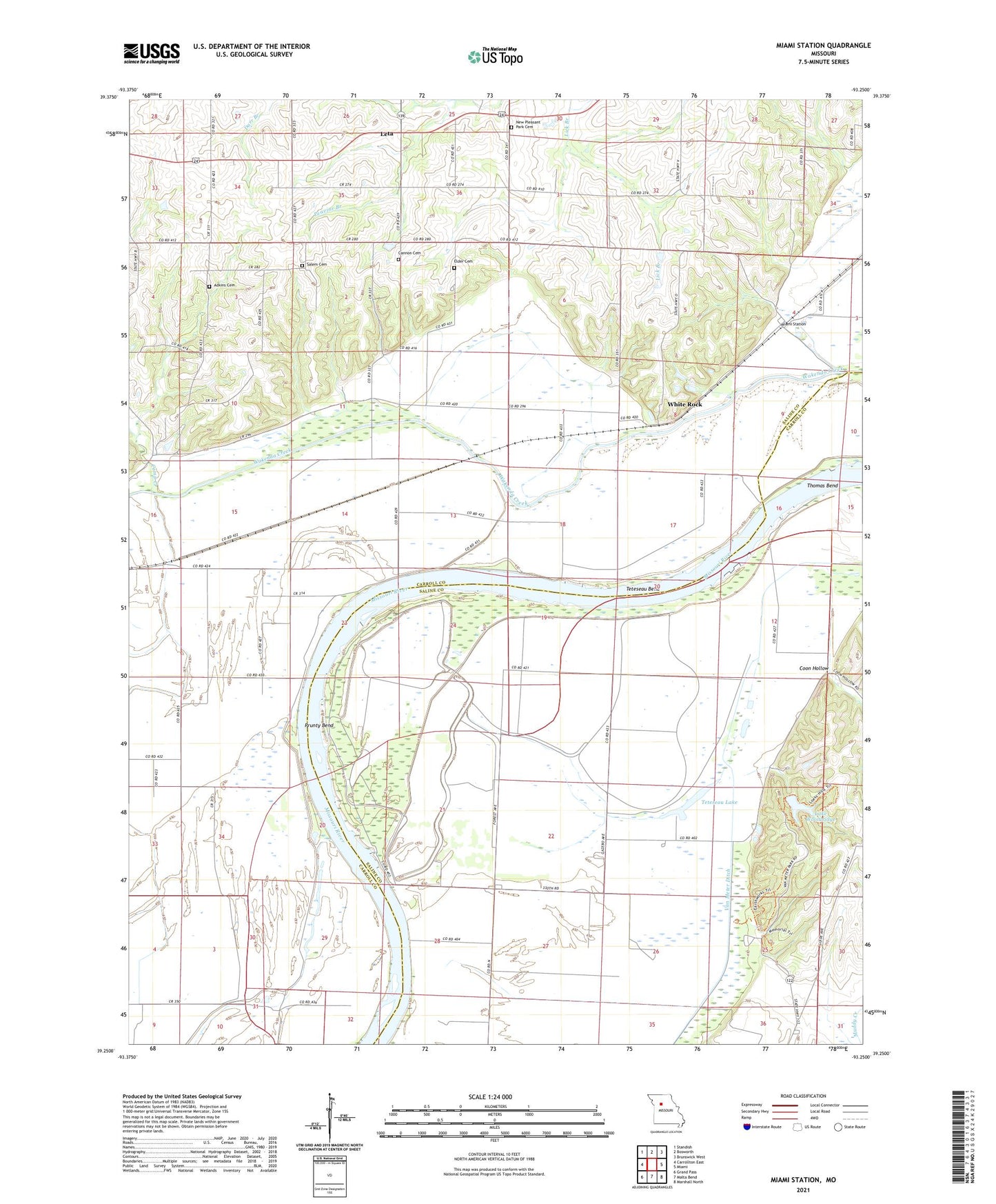
2021 topographic map quadrangle Miami Station in the state of Missouri. Scale: 1:24000. Based on the newly updated USGS 7.5' US Topo map series, this map is in the following counties: Carroll, Saline. The map contains contour data, water features, and other items you are used to seeing on USGS maps, but also has updated roads and other features. This is the next generation of topographic maps. Printed on high-quality waterproof paper with UV fade-resistant inks.
Quads adjacent to this one:
West: Carrollton East
Northwest: Standish
North: Bosworth
Northeast: Brunswick West
East: Miami
Southeast: Marshall North
South: Malta Bend
Southwest: Grand Pass
Contains the following named places: Adkins Cemetery, Bethlehem Church, Camp Creek, Cannon Cemetery, Coon Hollow, Elder Cemetery, Elderbloom School, Grand Pass Conservation Area, Gray School, Green Bud School, Lake Wooldridge, Leta, Little School, Lone Oak School, Miami Station, Miami Station School, Peavine School, Pleasant Park Church, Prunty Bend, Salem Cemetery, Teteseau Bend, Teteseau Lake, Thomas Bend, Township of Eugene, Township of Miami, Van Meter Dam, Van Meter Ditch, Van Meter School, Van Meter State Park, White Rock, White Rock School, Willow Grove School