MyTopo
Miller Missouri US Topo Map
Couldn't load pickup availability
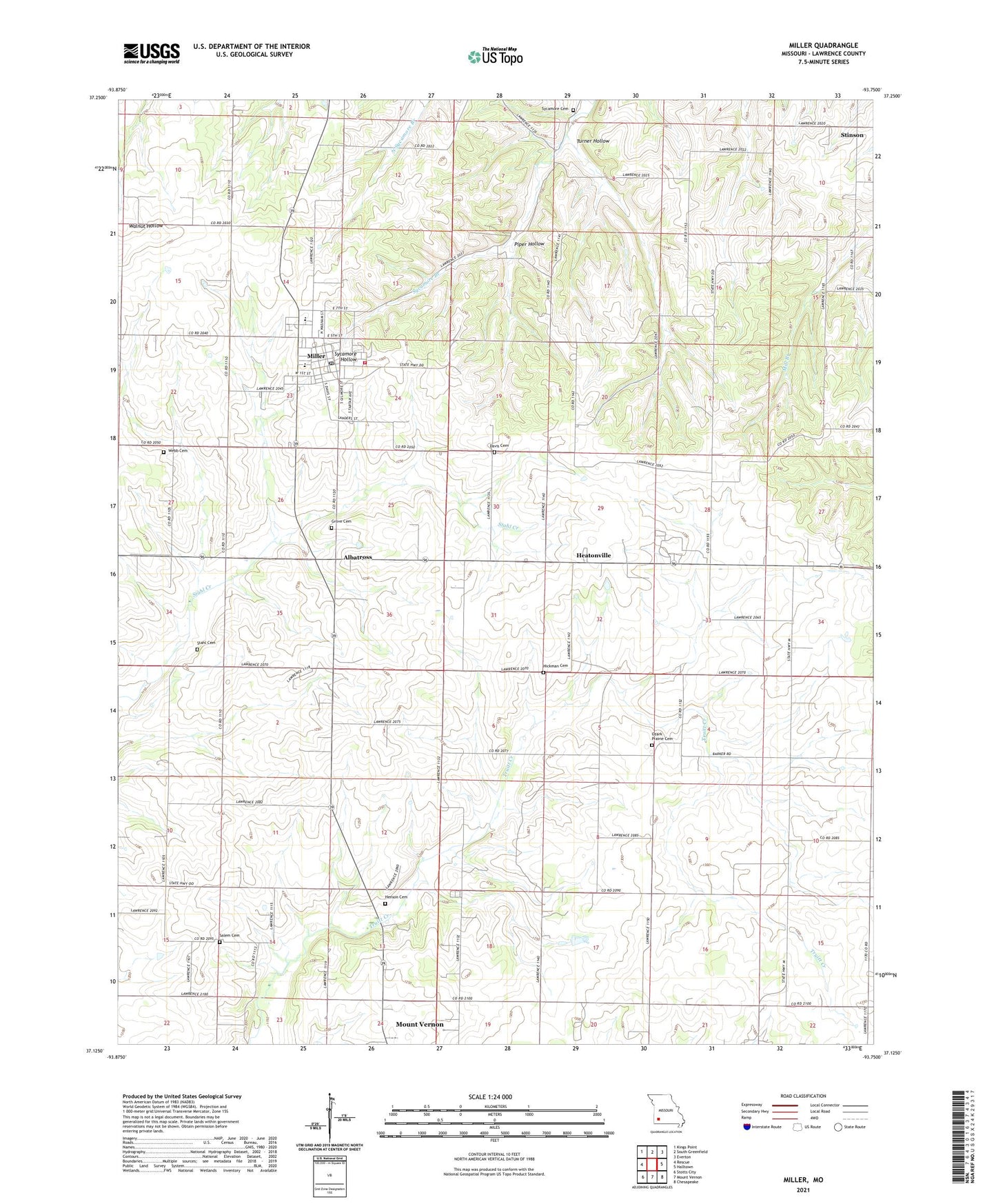
2021 topographic map quadrangle Miller in the state of Missouri. Scale: 1:24000. Based on the newly updated USGS 7.5' US Topo map series, this map is in the following counties: Lawrence. The map contains contour data, water features, and other items you are used to seeing on USGS maps, but also has updated roads and other features. This is the next generation of topographic maps. Printed on high-quality waterproof paper with UV fade-resistant inks.
Quads adjacent to this one:
West: Rescue
Northwest: Kings Point
North: South Greenfield
Northeast: Everton
East: Halltown
Southeast: Chesapeake
South: Mount Vernon
Southwest: Stotts City
Contains the following named places: Albatross, Call, Center School, Central Elementary School, City of Miller, Davis Cemetery, Fairplay School, Grove Cemetery, Heatonville, Heatonville School, Henson Cemetery, Hickman Cemetery, Highland Chapel, Liberty School, Miller, Miller Fire and Rescue, Miller High School, Miller Post Office, Miller Rural Fire Department, Ozark Prairie Cemetery, Ozark Prairie Church, Piper Hollow, Pleasant View School, Salem Cemetery, Salem Chapel, Shiloh School, South Sycamore School, Stahl Cemetery, Stinson, Stinson School, Summit Church, Sycamore Cemetery, Township of Lincoln, Turner Hollow, Webb Cemetery, ZIP Code: 65707