MyTopo
Stotts City Missouri US Topo Map
Couldn't load pickup availability
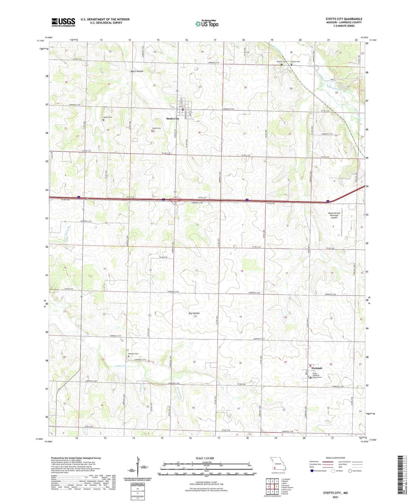
2021 topographic map quadrangle Stotts City in the state of Missouri. Scale: 1:24000. Based on the newly updated USGS 7.5' US Topo map series, this map is in the following counties: Lawrence. The map contains contour data, water features, and other items you are used to seeing on USGS maps, but also has updated roads and other features. This is the next generation of topographic maps. Printed on high-quality waterproof paper with UV fade-resistant inks.
Quads adjacent to this one:
West: Sarcoxie
Northwest: La Russell
North: Rescue
Northeast: Miller
East: Mount Vernon
Southeast: Verona
South: Monett
Southwest: Pierce City
This map covers the same area as the classic USGS quad with code o37093a8.
Contains the following named places: Advance School, Baptist Hill Assembly, Boucher Cemetery, City of Stotts City, East View Church, Freistatt, Freistatt Rural Farmers Fire Protection Association, German School, Hewlett Branch, Hopewell School, Independence School, Landrum, Maple Grove Church, Marti Hollow, Moore Cemetery, Mount Olivet Church, Mount Vernon Municipal Airport, Number Seven School, Patton Cemetery, Pruitt Branch, Raithel School, Shelton Cemetery, Stotts Cemetery, Stotts City, Stotts City Community Fire Department Station 2, Stotts City Post Office, Sylvan School, Talpa, Township of Freistatt, Township of Mount Pleasant, Trinity Lutheran Church Cemetery, Union Church, Union School, University of Missouri Experimental Farm, Village of Freistatt, Williams Creek, Zion Church, ZIP Codes: 65654, 65756