MyTopo
Liberal Missouri US Topo Map
Couldn't load pickup availability
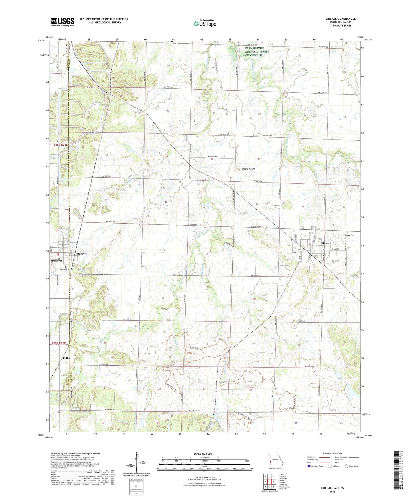
2021 topographic map quadrangle Liberal in the states of Missouri, Kansas. Scale: 1:24000. Based on the newly updated USGS 7.5' US Topo map series, this map is in the following counties: Barton, Crawford. The map contains contour data, water features, and other items you are used to seeing on USGS maps, but also has updated roads and other features. This is the next generation of topographic maps. Printed on high-quality waterproof paper with UV fade-resistant inks.
Quads adjacent to this one:
West: Arma
Northwest: Cato
North: Garland
Northeast: Bronaugh
East: Iantha
Southeast: Nashville
South: Mindenmines
Southwest: Pittsburg
This map covers the same area as the classic USGS quad with code o37094e5.
Contains the following named places: Alston, Ardath, Banner School, Bitter Creek, Burgess, Burgess Census Designated Place, City of Liberal, City of Mulberry, Coal Valley School, East Drywood Creek, Fairview School, Fleck Creek, Fuller, Galmartin School, Haake Mound, Hunkah Prairie State Wildlife Area, Konantz, Last Chance, Lester R Davis Memorial State Forest, Liberal, Liberal Cemetery, Liberal City Park, Liberal Elementary School, Liberal High School, Liberal Middle School, Liberal Police Department, Liberal Post Office, Liberal Rural Fire Department, Lone Star School, Lookout School, Miller Brothers, Mulberry, Mulberry City Hall, Mulberry City Park, Mulberry Fire Department, Mulberry Holiness Church, Mulberry Municipal Police Department, Mulberry Post Office, Pleasant View School, Rose Lake Dam, Rosebank Cemetery, Roses Lake, Second Nicolson Creek, Town of Burgess, Township of Leroy, Township of Ozark, West Elm Branch, ZIP Code: 64762