MyTopo
Iantha Missouri US Topo Map
Couldn't load pickup availability
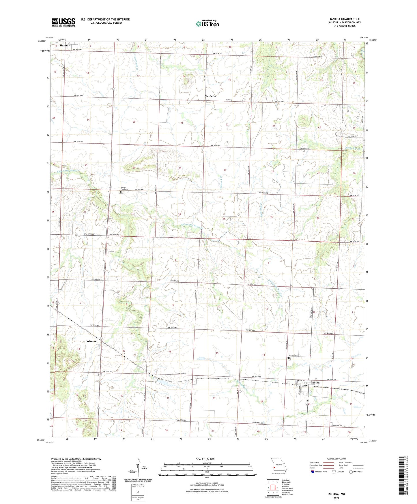
2021 topographic map quadrangle Iantha in the state of Missouri. Scale: 1:24000. Based on the newly updated USGS 7.5' US Topo map series, this map is in the following counties: Barton. The map contains contour data, water features, and other items you are used to seeing on USGS maps, but also has updated roads and other features. This is the next generation of topographic maps. Printed on high-quality waterproof paper with UV fade-resistant inks.
Quads adjacent to this one:
West: Liberal
Northwest: Garland
North: Bronaugh
Northeast: Sheldon
East: Lamar North
Southeast: Lamar South
South: Nashville
Southwest: Mindenmines
This map covers the same area as the classic USGS quad with code o37094e4.
Contains the following named places: Barton City Cemetery, Barton City School, Bryan School, Excelsior School, Farmer School, Gardner Farms Lake Dam, Hannon, Iantha, Iantha Cemetery, Iantha Census Designated Place, Logue Lake, Logue Lake Dam, Mayo Lake, Prairie Star School, Township of Barton City, Township of Central, Triumph School, Verdella, Verdella Church, West Union School, Wimmer