MyTopo
Minnith Missouri US Topo Map
Couldn't load pickup availability
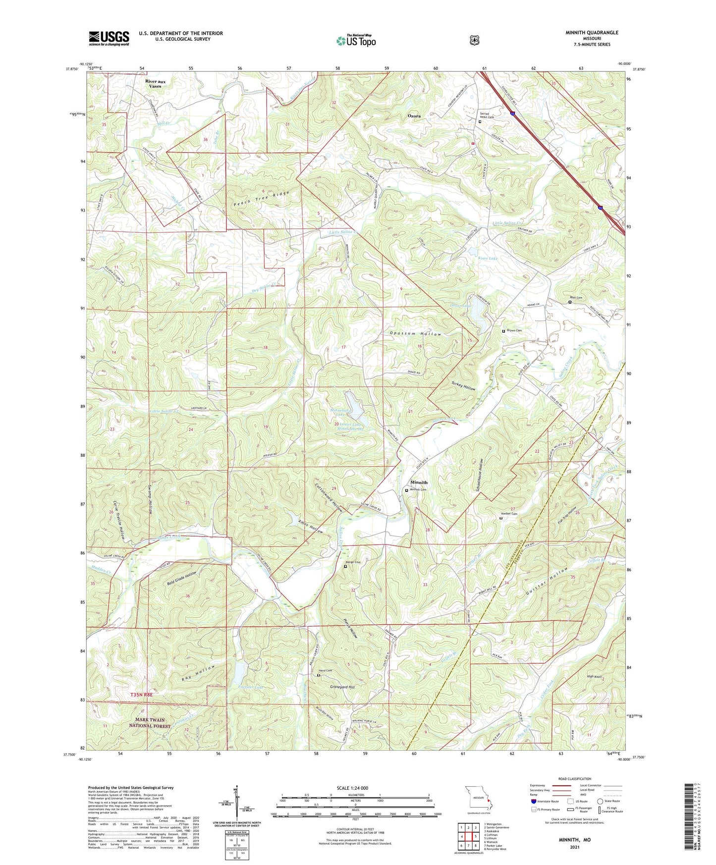
2021 topographic map quadrangle Minnith in the state of Missouri. Scale: 1:24000. Based on the newly updated USGS 7.5' US Topo map series, this map is in the following counties: Ste. Genevieve, Perry. The map contains contour data, water features, and other items you are used to seeing on USGS maps, but also has updated roads and other features. This is the next generation of topographic maps. Printed on high-quality waterproof paper with UV fade-resistant inks.
Quads adjacent to this one:
West: Coffman
Northwest: Weingarten
North: Sainte Genevieve
Northeast: Kaskaskia
East: Lithium
Southeast: Perryville West
South: Parker Lake
Southwest: Womack
Contains the following named places: Absher Lake Dam, Amos Hollow, Bald Glade Hollow, Boarman School, Bremen School, Brown Cemetery, Brushy Creek, Brushy School, Cedar Fork School, Cottonwood Hollow, Curve Trestle Hollow, Devils Den Hollow, Donze Lake, Donze Lake Dam, Dry Fork, Dry Saline Creek, Fish Trap Hollow, Foerster Dam, Foerster Lake, Giesler Lake Dam, Glen Basler Lake Dam, Graveyard Hill, Hand Cemetery, High Knoll, Hudson Lake Dam, Independence School, Johns Creek, Kisco Dam, Kisco Lake, Lake Minnie Ha-Ha Lower Dam, Lake Minnie Ha-Ha Upper Dam, Lower Lake Minnie Ha-Ha, Madden Creek, Mange Cemetery, Mill Creek, Minnehaha Lake, Minnith, Opossum Hollow, Ozora, Ozora Census Designated Place, Ozora Community Fire Protection Association, Ozora Marble Quarries, Peaceful Valley Camp, Peach Tree Ridge, Pierce Hollow, Ray Hollow, Ridgon School, River aux Vases, Roth Cemetery, Sacred Heart Catholic Church, Saline Baptist Church, Salt Petre Dam, Salt Petre Lake, Schoolhouse Hollow, South Fork Saline Creek, Swamp Hollow, Township of Beauvais, Tube Branch, Turkey Hollow, Voelker Branch, Voelker Cemetery, Walnut Creek