MyTopo
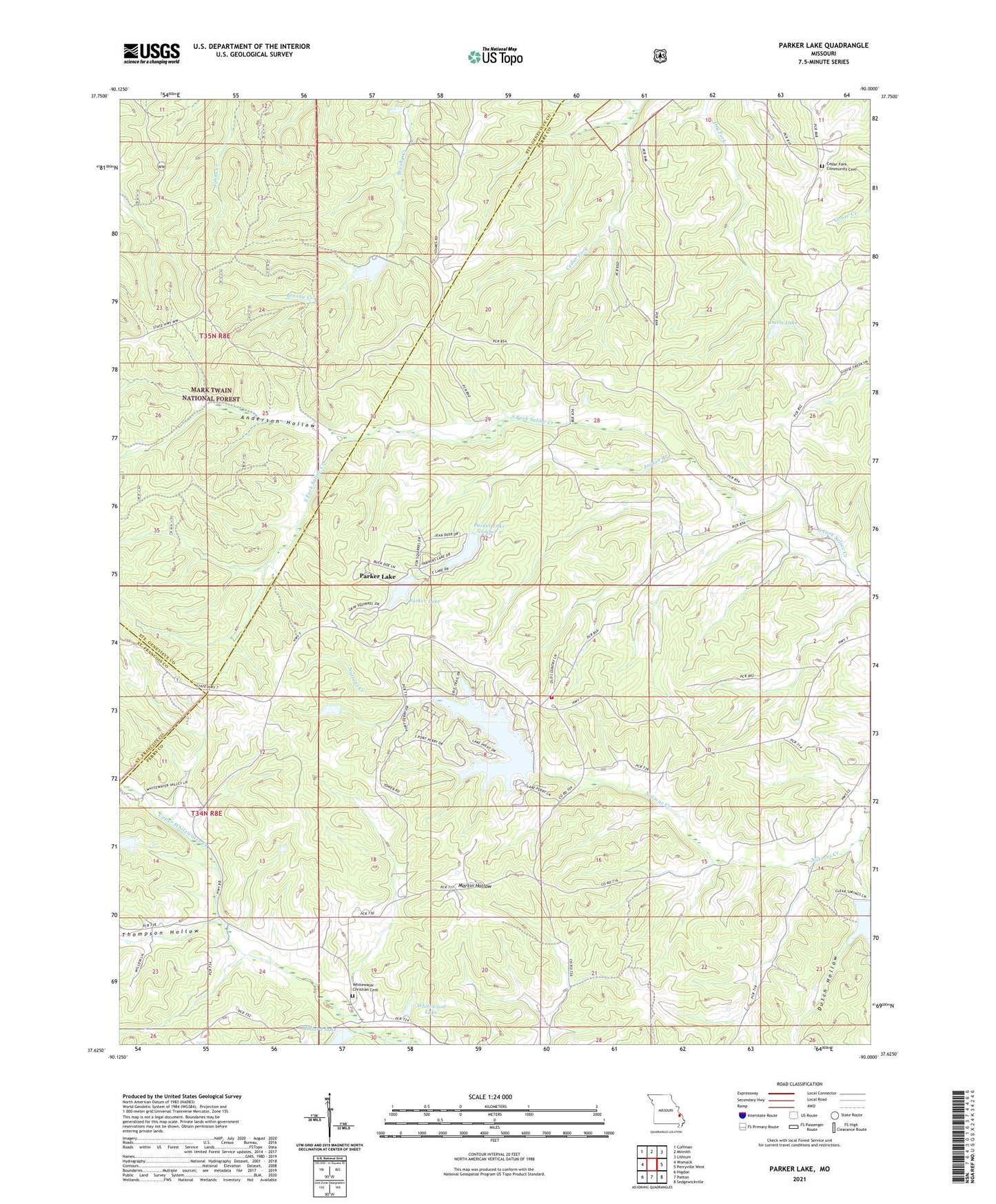
Parker Lake Missouri US Topo Map
Couldn't load pickup availability
Also explore the Parker Lake Forest Service Topo of this same quad for updated USFS data
2021 topographic map quadrangle Parker Lake in the state of Missouri. Scale: 1:24000. Based on the newly updated USGS 7.5' US Topo map series, this map is in the following counties: Perry, Ste. Genevieve, St. Francois. The map contains contour data, water features, and other items you are used to seeing on USGS maps, but also has updated roads and other features. This is the next generation of topographic maps. Printed on high-quality waterproof paper with UV fade-resistant inks.
Quads adjacent to this one:
West: Womack
Northwest: Coffman
North: Minnith
Northeast: Lithium
East: Perryville West
Southeast: Sedgewickville
South: Patton
Southwest: Higdon
This map covers the same area as the classic USGS quad with code o37090f1.
Contains the following named places: Anderson Hollow, Barks, Baudendistel School, Cedar Grove Church, Centenial School, Corners, Davis Lake, Dutch Hollow, Hidden Valley Lake Dam, Jordan Branch, Lake Kah-Tan-Da Number 2 Dam, Lake Kah-Tan-Da Number 3 Dam, Lake Perry, Layton School, Mallard Lake, Mallard Lake Dam, May School, Nations School, Parker Lake, Parker Lake Number 1 Dam, Parker Lake Number 2, Parker Lake Number 2 Dam, Perry Company Sportsmans Club Lake Dam, Perry County Fire Protection Association Station 2, Port Perry Dam, Port Perry Number 2 Lake, Port Perry Number 2 Lake Dam, Sleepy Hollow Lake Dam, The Lost Seven Lake Dam, Thompson Hollow, Township of Saint Marys, Walnut Grove School, Whitewater Church, Whitewood Lake, Whitewood Lake Dam