MyTopo
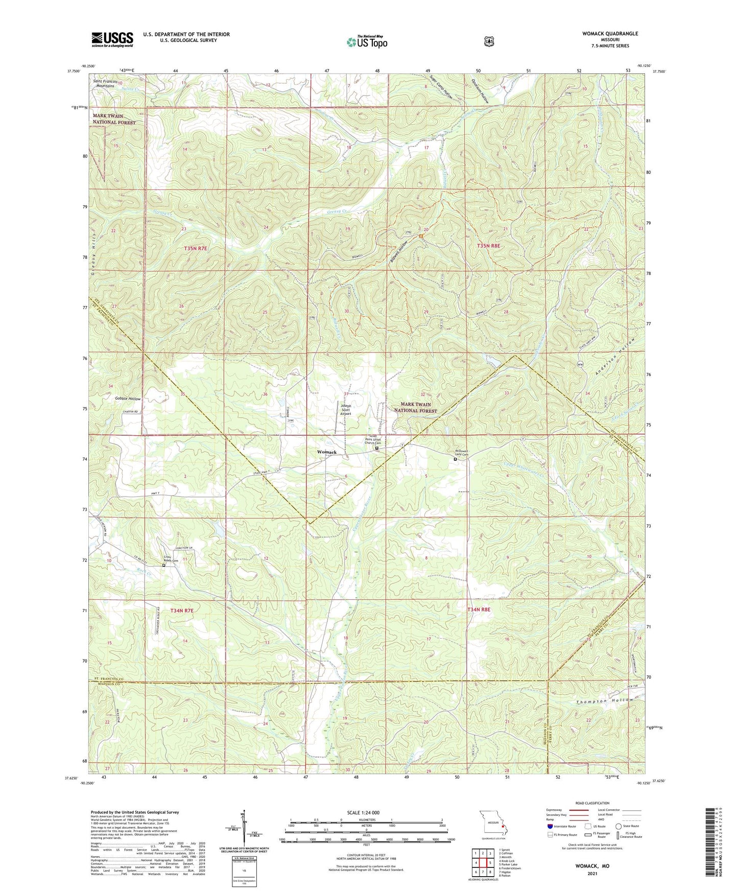
Womack Missouri US Topo Map
Couldn't load pickup availability
Also explore the Womack Forest Service Topo of this same quad for updated USFS data
2021 topographic map quadrangle Womack in the state of Missouri. Scale: 1:24000. Based on the newly updated USGS 7.5' US Topo map series, this map is in the following counties: Ste. Genevieve, St. Francois, Madison, Perry. The map contains contour data, water features, and other items you are used to seeing on USGS maps, but also has updated roads and other features. This is the next generation of topographic maps. Printed on high-quality waterproof paper with UV fade-resistant inks.
Quads adjacent to this one:
West: Knob Lick
Northwest: Sprott
North: Coffman
Northeast: Minnith
East: Parker Lake
Southeast: Patton
South: Higdon
Southwest: Fredericktown
This map covers the same area as the classic USGS quad with code o37090f2.
Contains the following named places: Bauman Lake Dam, Bethel Methodist Church, Bidwell Creek, Bidwell Hollow, Cross Roads, Crossroads Church, Crossroads School, Dalton Lake Dam, Downs School, Greasy Creek, Higdon Lookout Tower, John J Audubon Trail, Joseph Scott Airport, McDowell - Lenz Cemetery, Nations Mill, Opossum Hollow, Rockwood School, Silver Point Church, Sugar Camp Hollow, Unity School, Whitewater Lookout Tower, Womack, Womack School