MyTopo
Modena Missouri US Topo Map
Couldn't load pickup availability
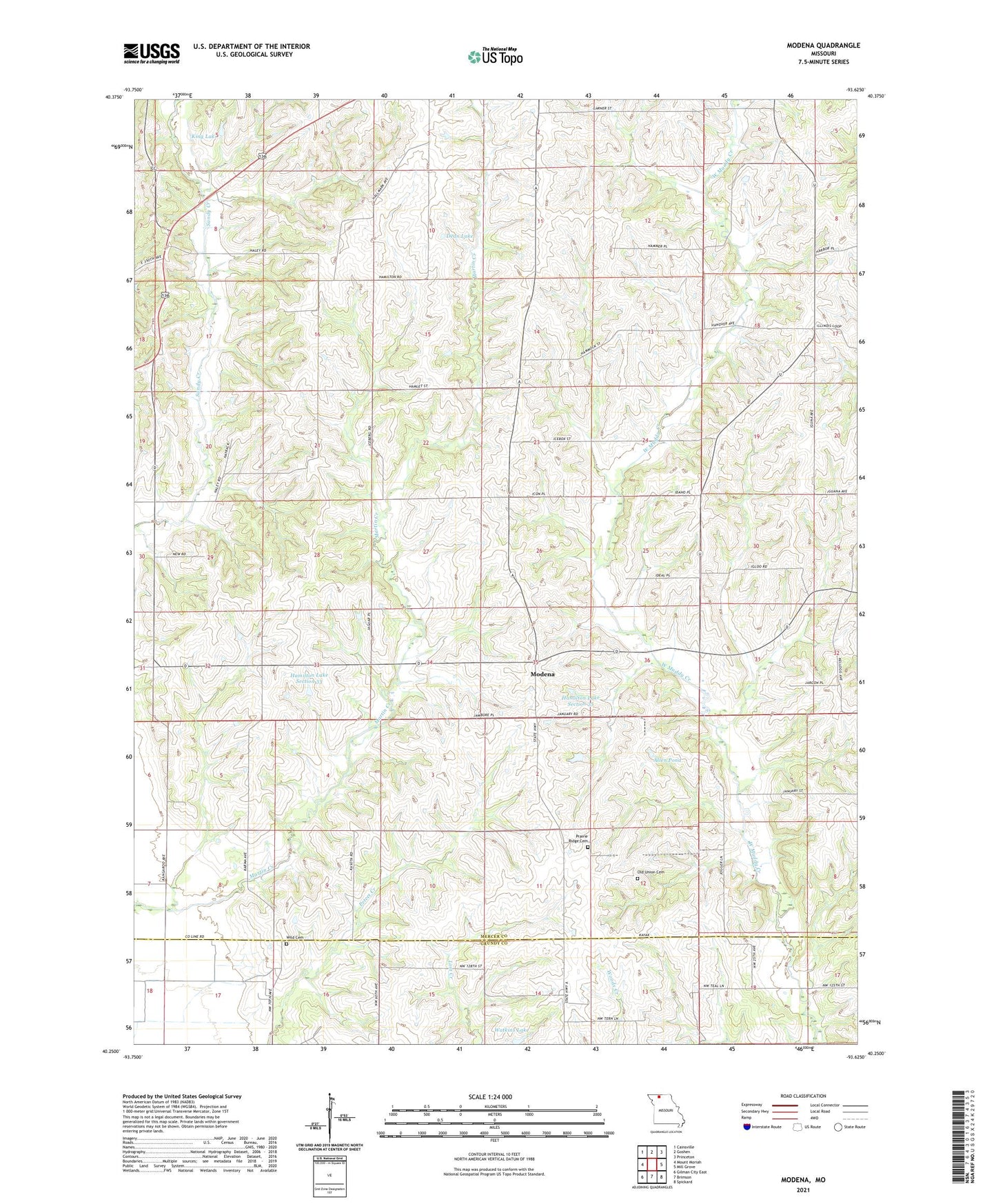
2021 topographic map quadrangle Modena in the state of Missouri. Scale: 1:24000. Based on the newly updated USGS 7.5' US Topo map series, this map is in the following counties: Mercer, Grundy. The map contains contour data, water features, and other items you are used to seeing on USGS maps, but also has updated roads and other features. This is the next generation of topographic maps. Printed on high-quality waterproof paper with UV fade-resistant inks.
Quads adjacent to this one:
West: Mount Moriah
Northwest: Cainsville
North: Goshen
Northeast: Princeton
East: Mill Grove
Southeast: Spickard
South: Brimson
Southwest: Gilman City East
Contains the following named places: Allen Dam, Allen Pond, Bain School, Bethlehem School, Centennial School, Cherokee School, Dean Lake, Dean Lake Dam, Dinsmore, Hamilton Lake Section 33, Hamilton Lake Section 33 Dam, Hamilton Lake Section 35, Hamilton Lake Section 35 Dam, Hamilton School, King Lake, King Lake Dam, Maple Grove School, Modena, Modena School, Nigh School, Norton School, Old Union Cemetery, Prairie Ridge Cemetery, Salem School, Squires School, Star School, Township of Madison, Walters School, Watkins Lake, Watkins Lake Dam, West High Point School, Wild Cemetery