MyTopo
Mountain Grove North Missouri US Topo Map
Couldn't load pickup availability
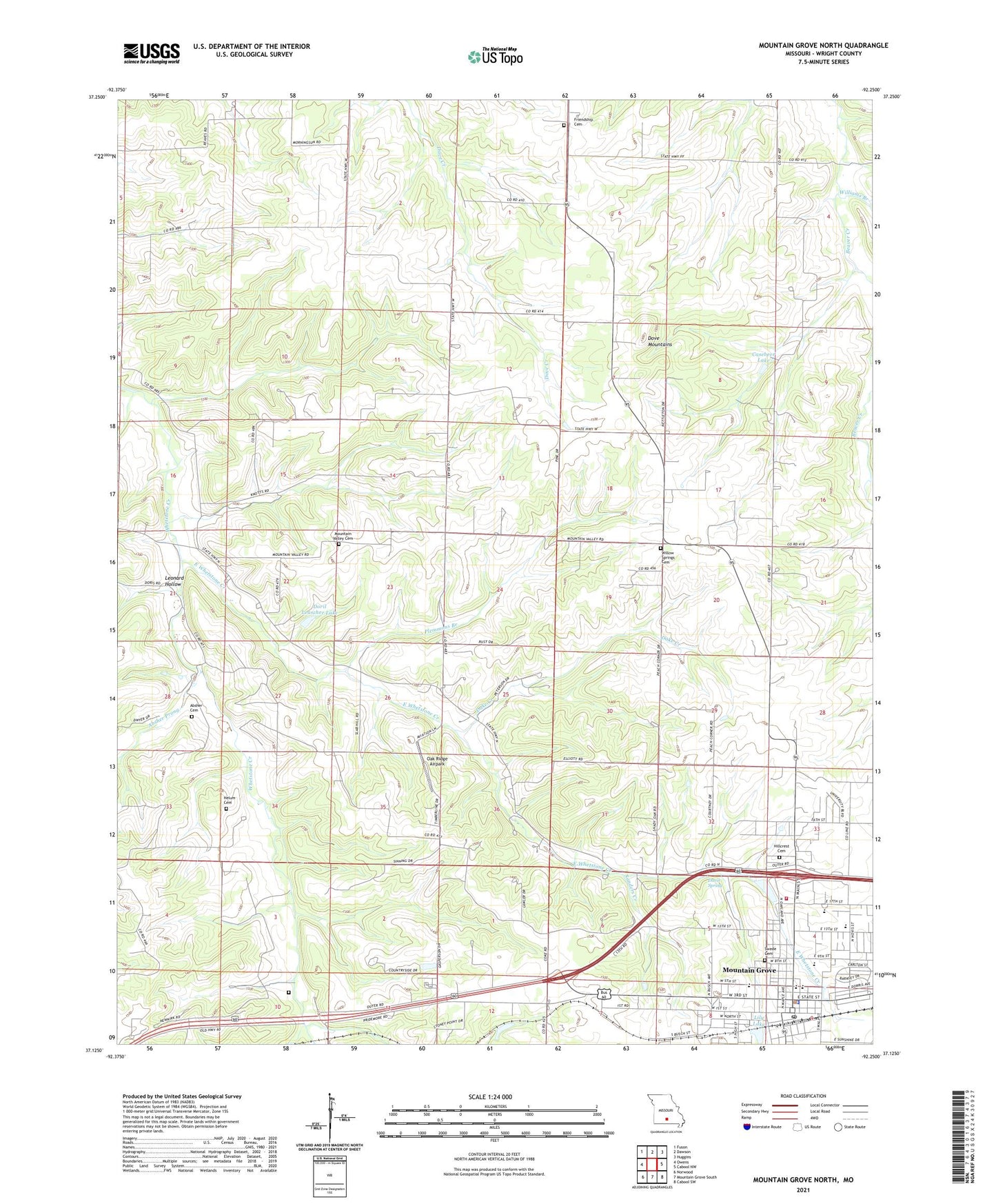
2021 topographic map quadrangle Mountain Grove North in the state of Missouri. Scale: 1:24000. Based on the newly updated USGS 7.5' US Topo map series, this map is in the following counties: Wright. The map contains contour data, water features, and other items you are used to seeing on USGS maps, but also has updated roads and other features. This is the next generation of topographic maps. Printed on high-quality waterproof paper with UV fade-resistant inks.
Quads adjacent to this one:
West: Owens
Northwest: Fuson
North: Dawson
Northeast: Huggins
East: Cabool NW
Southeast: Cabool SW
South: Mountain Grove South
Southwest: Norwood
This map covers the same area as the classic USGS quad with code o37092b3.
Contains the following named places: Absher Cemetery, Absher Prong, Antler, Antler Post Office, Casebeer Lake, Casebeer Lake Dam, City of Mountain Grove, Cross Roads School, Dake Creek, Davis Spring, Doril Leascher Lake, Dove Mountains, East Whetstone Creek, Fairview Church, Fairview School, Friendship Baptist Church, Friendship Cemetery, Hawley, Hawley Post Office, Helum Cemetery, Hilcrest Shopping Center, Hillcrest Cemetery, Leascher Lake Dam, Leonard Hollow, Lily Lake, Morning Sun Church, Morning Sun School, Mountain Grove, Mountain Grove Police Department, Mountain Grove Post Office, Mountain Grove Volunteer Fire Department North Station, Mountain Valley Cemetery, Mountain Valley Church, Mountain Valley School, North Campbell School, Number 284 Dam, Oak Ridge Airpark, Plemmons Branch, Porter Lake, Porter Lake Dam, Sanders Creek, Stony Point Church, Swede Cemetery, Township of Wood, West Campbell School, Whetstone, Whetstone Church, Williams Branch, Willow Springs Cemetery, Willow Springs School, ZIP Code: 65711