MyTopo
Cabool NW Missouri US Topo Map
Couldn't load pickup availability
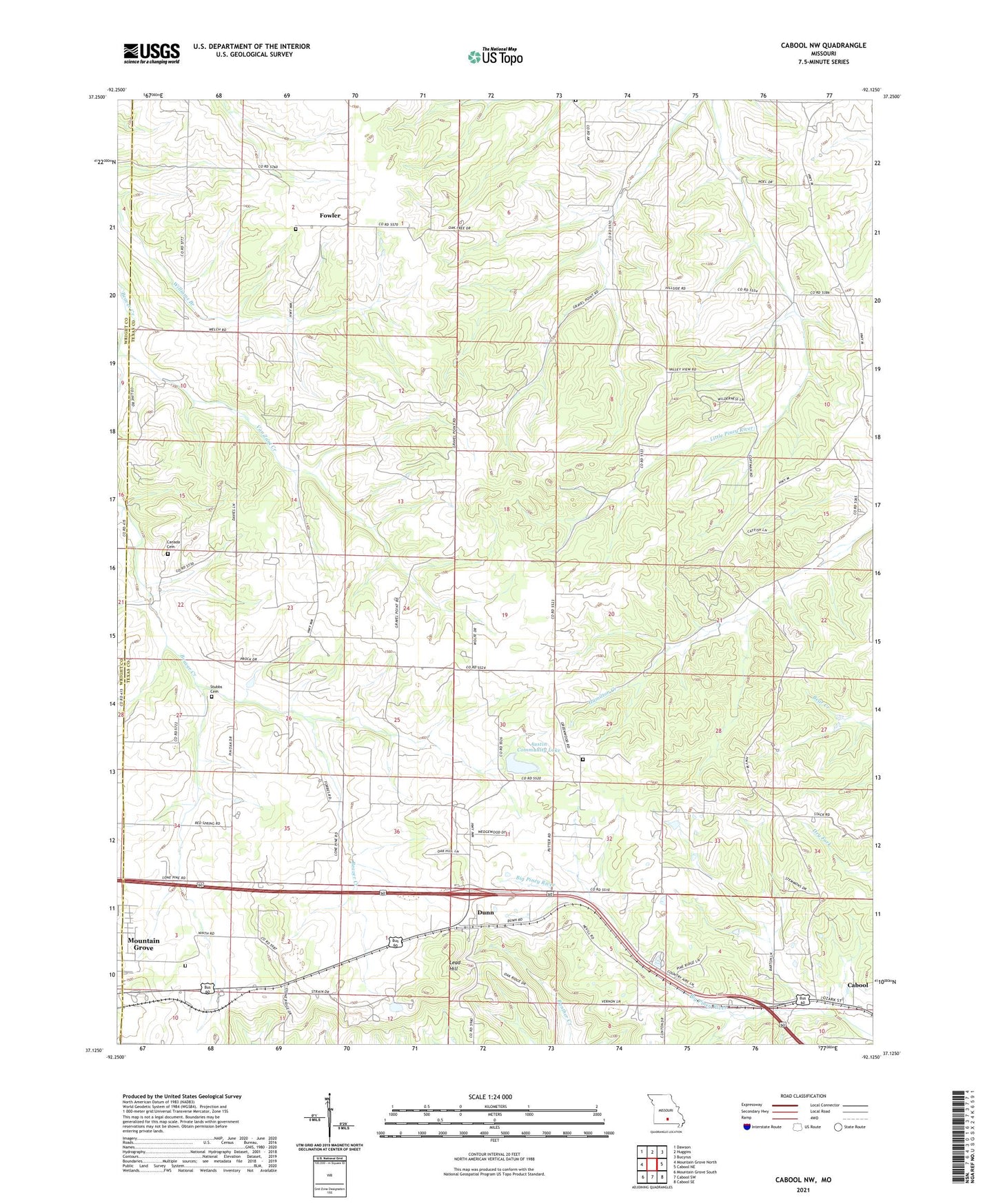
2021 topographic map quadrangle Cabool NW in the state of Missouri. Scale: 1:24000. Based on the newly updated USGS 7.5' US Topo map series, this map is in the following counties: Texas, Wright. The map contains contour data, water features, and other items you are used to seeing on USGS maps, but also has updated roads and other features. This is the next generation of topographic maps. Printed on high-quality waterproof paper with UV fade-resistant inks.
Quads adjacent to this one:
West: Mountain Grove North
Northwest: Dawson
North: Huggins
Northeast: Bucyrus
East: Cabool NE
Southeast: Cabool SE
South: Cabool SW
Southwest: Mountain Grove South
This map covers the same area as the classic USGS quad with code o37092b2.
Contains the following named places: Austin Community Lake, Austin Community Lake Dam, Brushy Knob School, Cabool State Wildlife Management Area, Canada Cemetery, Cedar Grove Church, Dunn, Fowler, Gravel Point, Gravel Point School, Greenwood Church, Hanks, KRFI-AM (Mountain Grove), KRFI-FM (Mountain Grove), KVVC-FM (Cabool), Larson State Wildlife Management Area, Lead Hill, Mount Zion Church, Mount Zion School, Noels Store, Stubbs Cemetery, Stubbs School, Township of Clinton, Van Zant Creek, Walnut Grove School, Weatherman School