MyTopo
Mountain Grove South Missouri US Topo Map
Couldn't load pickup availability
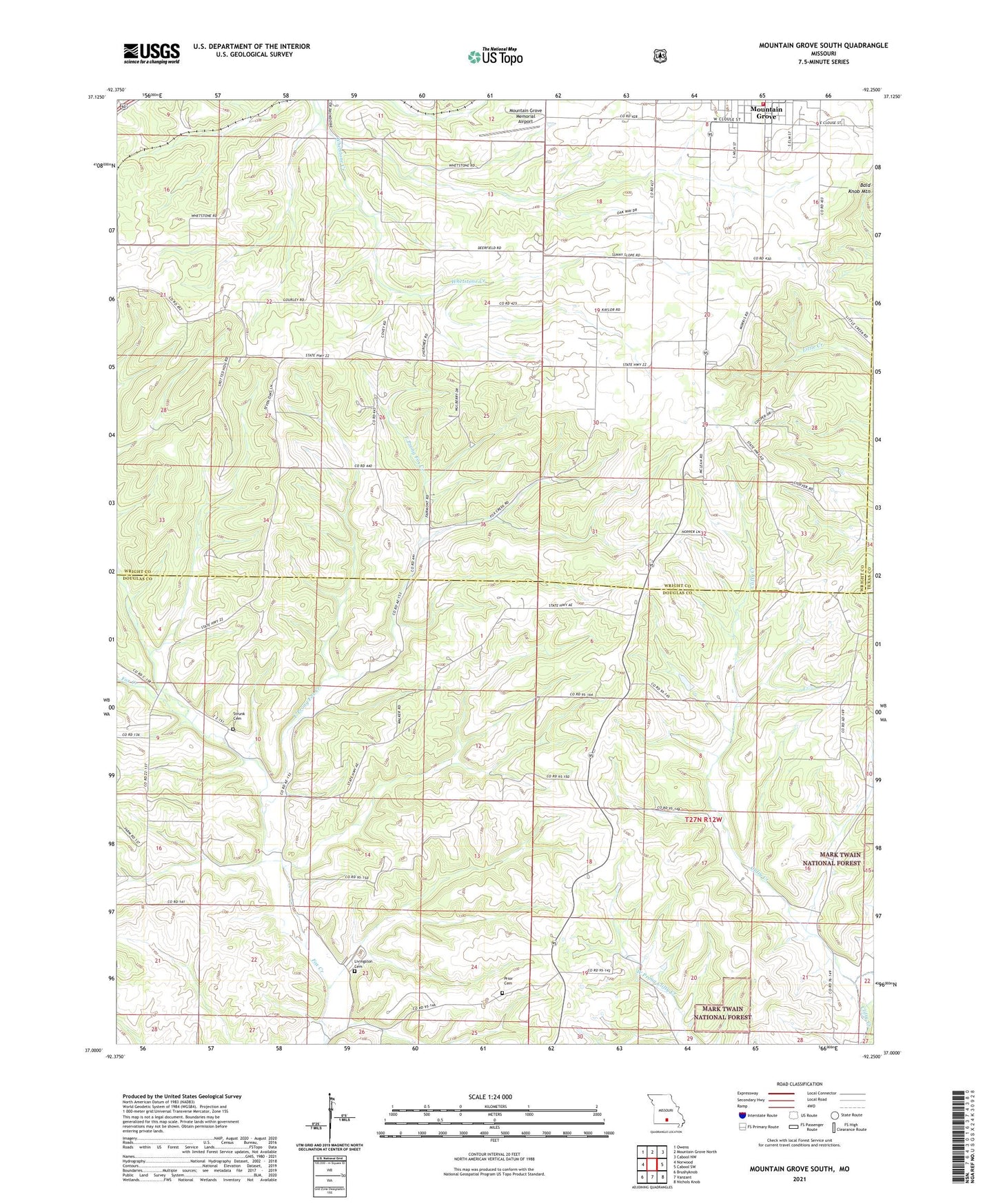
2021 topographic map quadrangle Mountain Grove South in the state of Missouri. Scale: 1:24000. Based on the newly updated USGS 7.5' US Topo map series, this map is in the following counties: Douglas, Wright, Texas. The map contains contour data, water features, and other items you are used to seeing on USGS maps, but also has updated roads and other features. This is the next generation of topographic maps. Printed on high-quality waterproof paper with UV fade-resistant inks.
Quads adjacent to this one:
West: Norwood
Northwest: Owens
North: Mountain Grove North
Northeast: Cabool NW
East: Cabool SW
Southeast: Nichols Knob
South: Vanzant
Southwest: Brushyknob
Contains the following named places: Bald Knob Mountain, East Clifty Creek, East Prong Fox Creek, Fairmount Church, Fairmount School, Glendale School, Goodville, Livingston Cemetery, Lone Star Church, Lone Star School, Mathis Cemetery, Mint Springs School, Mountain Grove Memorial Airport, Mountain Grove Volunteer Fire Department South Station, Oak Grove School, Pleasant Hill School, Prior, Prior Church, Strunk Cemetery, Sunnyslope School, Township of Cass, Township of Mountain Grove, Township of Wood