MyTopo
Nettleton Missouri US Topo Map
Couldn't load pickup availability
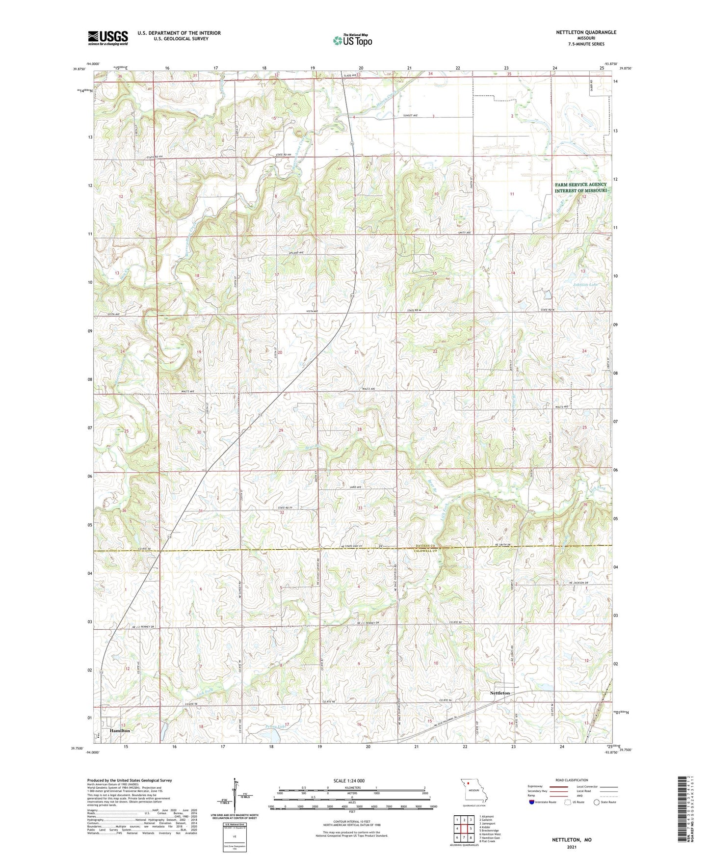
2021 topographic map quadrangle Nettleton in the state of Missouri. Scale: 1:24000. Based on the newly updated USGS 7.5' US Topo map series, this map is in the following counties: Daviess, Caldwell. The map contains contour data, water features, and other items you are used to seeing on USGS maps, but also has updated roads and other features. This is the next generation of topographic maps. Printed on high-quality waterproof paper with UV fade-resistant inks.
Quads adjacent to this one:
West: Kidder
Northwest: Altamont
North: Gallatin
Northeast: Jamesport
East: Breckenridge
Southeast: Flat Creek
South: Hamilton East
Southwest: Hamilton West
Contains the following named places: Bear Branch, Bear Branch School, Byron Simpson Lake, Byron Simpson Lake Dam, Dog Creek, Foley School, Hamilton Middle School, Haw Branch, Haw Branch School, Hickory Grove School, John Simpson Lake Dam, Johnson Lake, Johnson Land Development Lake Dam, Locust Grove School, Long Branch, Marrowbone Creek, Monroe Chapel, Mount Pleasant School, Nettleton, Penney High School, Penny Lake, Prairie View School, Shinar School, Township of Monroe, Whitt School