MyTopo
New Point Missouri US Topo Map
Couldn't load pickup availability
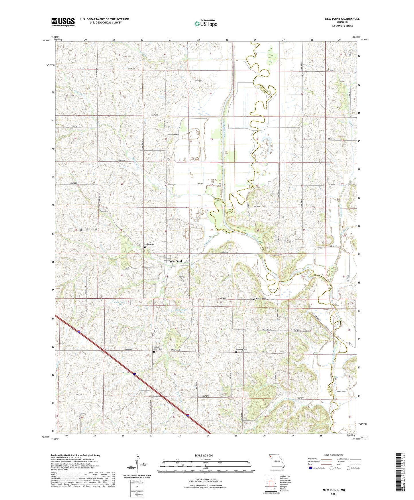
2021 topographic map quadrangle New Point in the state of Missouri. Scale: 1:24000. Based on the newly updated USGS 7.5' US Topo map series, this map is in the following counties: Holt, Andrew. The map contains contour data, water features, and other items you are used to seeing on USGS maps, but also has updated roads and other features. This is the next generation of topographic maps. Printed on high-quality waterproof paper with UV fade-resistant inks.
Quads adjacent to this one:
West: Kimsey Creek
Northwest: Mound City
North: Maitland
Northeast: Bolckow NW
East: Fillmore
Southeast: Amazonia
South: Forbes
Southwest: Oregon
Contains the following named places: Arapahoe Creek, Cain Farm Lake, Cain Farm Lake Dam, Carroll Branch, Christian Camp, Cowan Cemetery, Eureka School, Fairview Cemetery, Glen Meyer Dam, Glen Meyer Lake, Hickory Creek, Hog Creek, Lone Corner, Lone Corner School, Long Center School, Marion School, McGuire Cemetery, New Point, New Point Census Designated Place, Nichols Creek, Nichols Grove, Nichols Grove Cemetery, Nichols Grove Church, Nodaway Cemetery, Nodaway River Ditch, Owl Creek, Pedlar Creek, Richville School, Township of Hickory, Township of Nodaway, Triumph School