MyTopo
Norwood Missouri US Topo Map
Couldn't load pickup availability
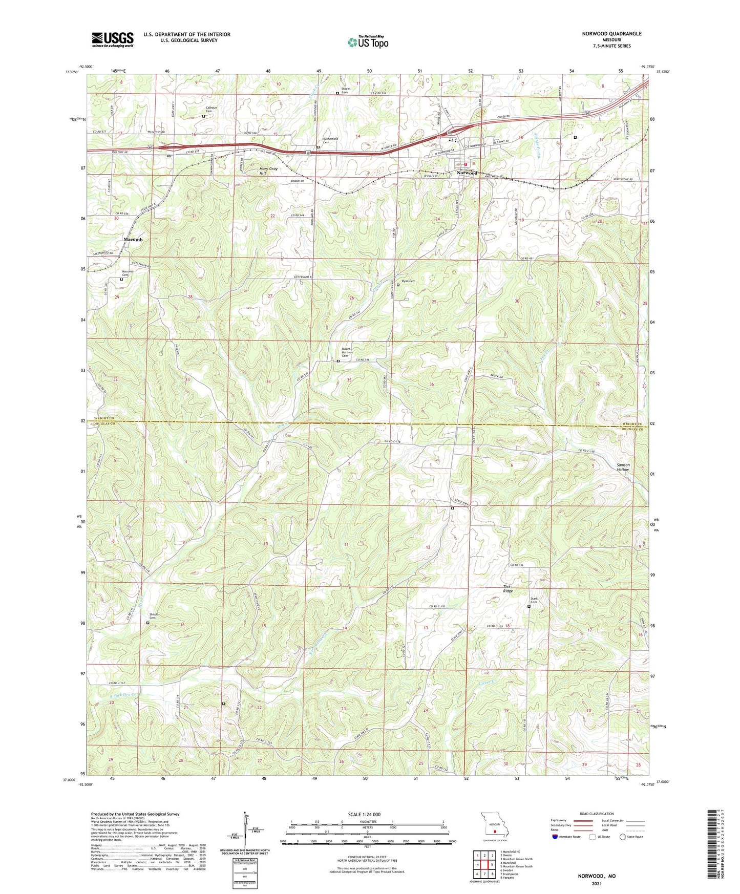
2021 topographic map quadrangle Norwood in the state of Missouri. Scale: 1:24000. Based on the newly updated USGS 7.5' US Topo map series, this map is in the following counties: Douglas, Wright. The map contains contour data, water features, and other items you are used to seeing on USGS maps, but also has updated roads and other features. This is the next generation of topographic maps. Printed on high-quality waterproof paper with UV fade-resistant inks.
Quads adjacent to this one:
West: Mansfield
Northwest: Mansfield NE
North: Owens
Northeast: Mountain Grove North
East: Mountain Grove South
Southeast: Vanzant
South: Brushyknob
Southwest: Sweden
Contains the following named places: Brutons, Calhoun Cemetery, City of Norwood, Cornelius School, Fairview Church, Fairview School, Filer, Filer Post Office, Forest Home School, Hickory Flat School, Macomb, Macomb Cemetery, Macomb Post Office, Macomb School, Mary Gray Hill, McIntosh Lake Dam, Mount Harmon Cemetery, New Haven Church, Norwood, Norwood Post Office, Norwood Volunteer Fire Department, Oak Forest Church, Retherford Cemetery, Ryan Cemetery, Saint James School, Samson Hollow, Shiloh Cemetery, Shores Cemetery, Stark Cemetery, Stony Point School, Tick Ridge, Township of Clark, Township of Clay, ZIP Codes: 65702, 65717