MyTopo
Oates Missouri US Topo Map
Couldn't load pickup availability
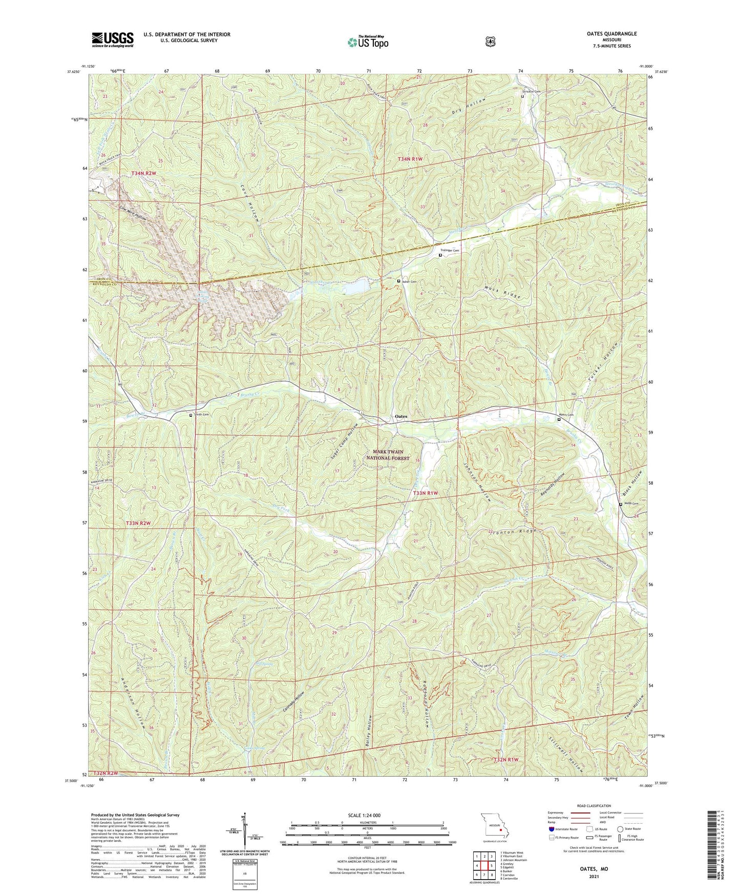
2021 topographic map quadrangle Oates in the state of Missouri. Scale: 1:24000. Based on the newly updated USGS 7.5' US Topo map series, this map is in the following counties: Reynolds, Iron. The map contains contour data, water features, and other items you are used to seeing on USGS maps, but also has updated roads and other features. This is the next generation of topographic maps. Printed on high-quality waterproof paper with UV fade-resistant inks.
Quads adjacent to this one:
West: Greeley
Northwest: Viburnum West
North: Viburnum East
Northeast: Johnson Mountain
East: Edgehill
Southeast: Centerville
South: Corridon
Southwest: Bunker
Contains the following named places: Amax Tailing Pond, Anderson Hollow, Asher Cemetery, Barton School, Bell Mountain Vista Picnic Area, Black Hollow, Black Lookout Tower, Bowen Branch, Buick Mine, Buick Mine Tailings Dam, Cannady Hollow, Cave Hollow, Clones, Cooks Spring, Cow Mire Hollow, Dry Fork, Dry Hollow, Gunnis Creek, Happy Home Church, Hawk School, Henry Branch, Ironton Ridge, Johnson Hollow, Little Creek, Mack Ridge, Mill Spring, Missouri Branch, Moses Store, Myers Cemetery, Neals Creek, Oates, Oates Lookout Tower, Oates School, Pleasant Union Church, Reynolds Hollow, Smith Cemetery, Stricklin Cemetery, Sugar Camp Hollow, Trolinger Cemetery, Tucker Hollow, Webb Cemetery, Wolf Creek