MyTopo
Ozark Missouri US Topo Map
Couldn't load pickup availability
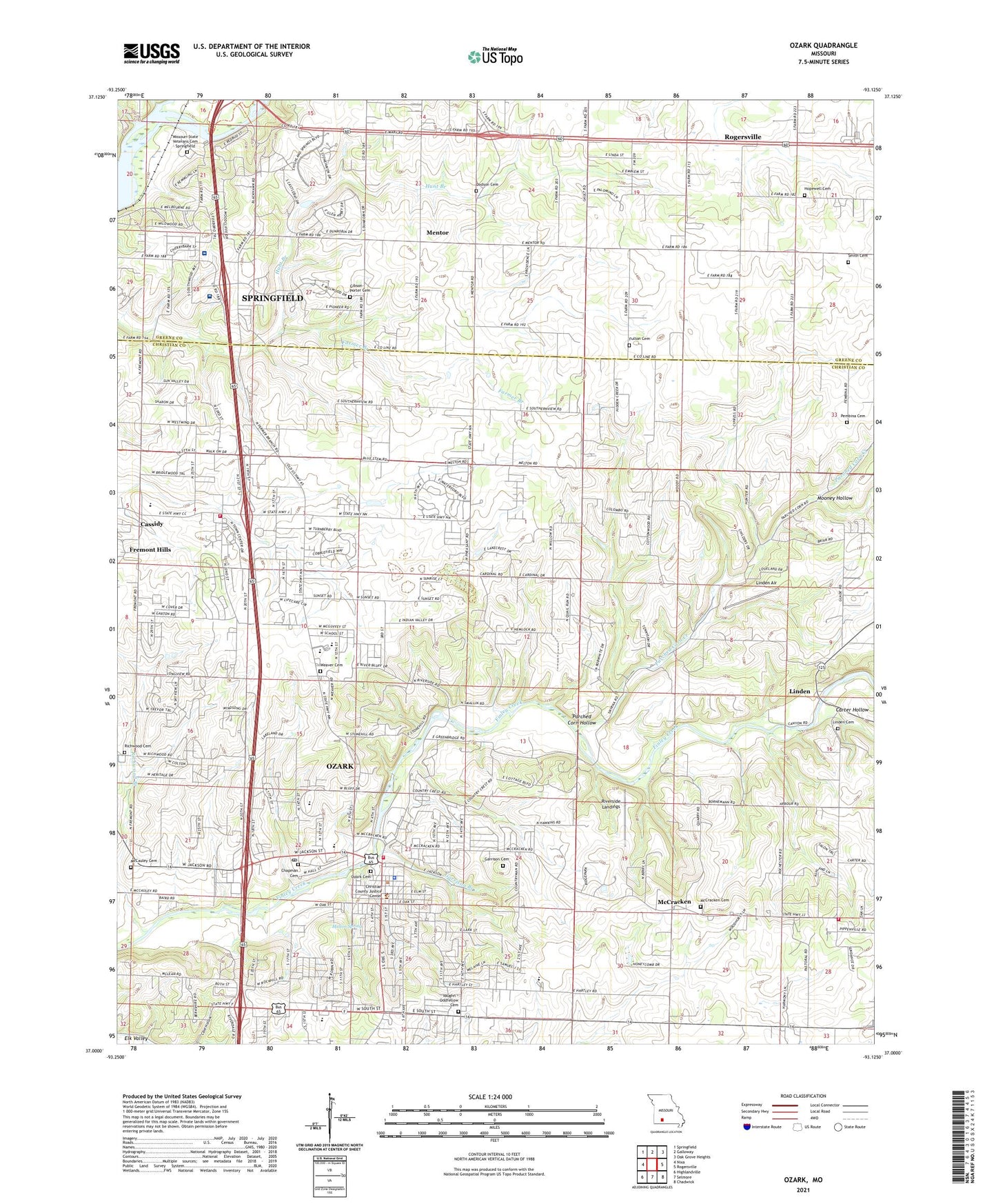
2021 topographic map quadrangle Ozark in the state of Missouri. Scale: 1:24000. Based on the newly updated USGS 7.5' US Topo map series, this map is in the following counties: Christian, Greene. The map contains contour data, water features, and other items you are used to seeing on USGS maps, but also has updated roads and other features. This is the next generation of topographic maps. Printed on high-quality waterproof paper with UV fade-resistant inks.
Quads adjacent to this one:
West: Nixa
Northwest: Springfield
North: Galloway
Northeast: Oak Grove Heights
East: Rogersville
Southeast: Chadwick
South: Selmore
Southwest: Highlandville
Contains the following named places: Air Park South, Carter Hollow, Cassidy, Center Point Church, Chapman Cemetery, Christian County Sheriff's Office, City of Ozark, Cowan, Cowan School, Fremont Hills, Fulton Cemetery, Gardner Airport, Garrison Branch, Garrison Cemetery, Gibson-Porter Cemetery, Hedges Spur, Hopedale Church, Hopedale School, Hopewell Cemetery, Hunt Branch, Kelly Cemetery, KSWM-AM (Republic), Linden, Linden Air, Linden Chapel, Lindenlure Lake, McCauley Cemetery, McCracken, Melton Spring, Mentor, Missouri State Veterans Cemetery - Springfield, Mooney Hollow, Mount Pleasant School, Mount Zion Church, Ozark, Ozark Fire Protection District Station 1, Ozark Fire Protection District Station 2, Ozark Fire Protection District Station 4, Ozark Police Department, Ozark Post Office, Palace, Parched Corn Creek, Parched Corn Hollow, Pembina, Pembina Cemetery, Porter Cemetery, Richwood Branch, Richwood Cemetery, Riverside Landings, Saint Joseph Church, Smith Cemetery, Smyrna Church, Thompson Creek, Tilman School, Township of Cassidy, Township of Clay B, Township of Finley, Township of Riverside, Vaughn - Oddfellow Cemetery, Weaver Cemetery, Whites Spur, Wolf School