MyTopo
Paris East Missouri US Topo Map
Couldn't load pickup availability
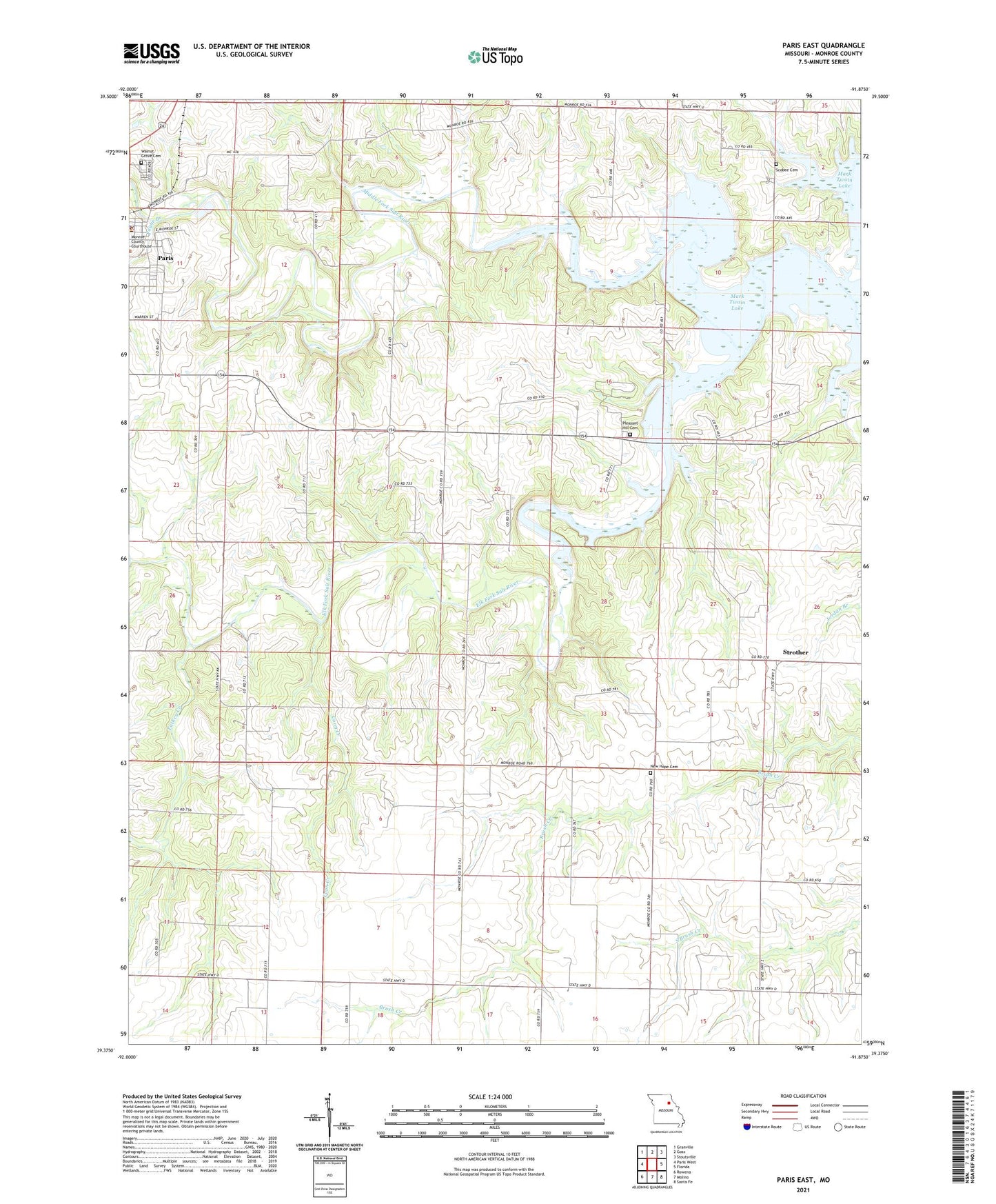
2021 topographic map quadrangle Paris East in the state of Missouri. Scale: 1:24000. Based on the newly updated USGS 7.5' US Topo map series, this map is in the following counties: Monroe. The map contains contour data, water features, and other items you are used to seeing on USGS maps, but also has updated roads and other features. This is the next generation of topographic maps. Printed on high-quality waterproof paper with UV fade-resistant inks.
Quads adjacent to this one:
West: Paris West
Northwest: Granville
North: Goss
Northeast: Stoutsville
East: Florida
Southeast: Santa Fe
South: Molino
Southwest: Rowena
Contains the following named places: Cedar Grove Church, Coon Creek, Elk Fork Salt River, Gleason School, Kirkland School, McGee School, McKamey School, Mississippi River Hills, Monroe County Sheriff's Office, New Hope Cemetery, Oak Ridge Church, Oak Ridge School, Paris Junior High School, Payne Branch, Pleasant Hill Cemetery, Pleasant View Rest Home, Powers School, Samuel L. Clemens Memorial Airport, Scobee Cemetery, Strother, Turkey Creek, Walnut Grove Cemetery, ZIP Code: 65275