MyTopo
Granville Missouri US Topo Map
Couldn't load pickup availability
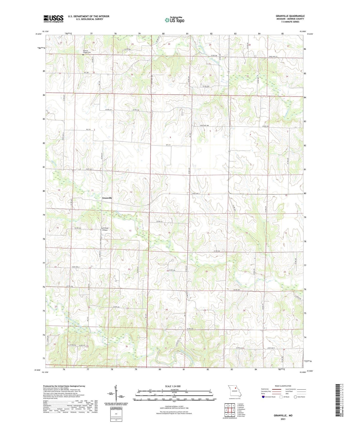
2021 topographic map quadrangle Granville in the state of Missouri. Scale: 1:24000. Based on the newly updated USGS 7.5' US Topo map series, this map is in the following counties: Monroe. The map contains contour data, water features, and other items you are used to seeing on USGS maps, but also has updated roads and other features. This is the next generation of topographic maps. Printed on high-quality waterproof paper with UV fade-resistant inks.
Quads adjacent to this one:
West: Woodlawn
Northwest: Lentner
North: Shelbina
Northeast: Lakenan
East: Goss
Southeast: Paris East
South: Paris West
Southwest: Madison
This map covers the same area as the classic USGS quad with code o39092e1.
Contains the following named places: Carl Ensor Airport, Cradle of Science School, Crooked Creek Church, Duncan Creek, Dye Lake Dam, Granville, Granville School, Heathman School, Little Otter Creek, Salem Church, Salem School, Smizer School, Spencer Chapel Cemetery, Spencer Chapel School, Township of Clay