MyTopo
Patton Missouri US Topo Map
Couldn't load pickup availability
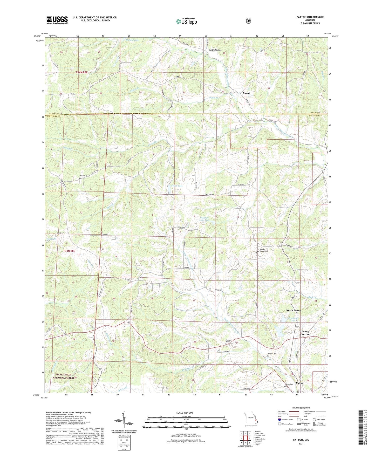
2021 topographic map quadrangle Patton in the state of Missouri. Scale: 1:24000. Based on the newly updated USGS 7.5' US Topo map series, this map is in the following counties: Bollinger, Perry. The map contains contour data, water features, and other items you are used to seeing on USGS maps, but also has updated roads and other features. This is the next generation of topographic maps. Printed on high-quality waterproof paper with UV fade-resistant inks.
Quads adjacent to this one:
West: Higdon
Northwest: Womack
North: Parker Lake
Northeast: Perryville West
East: Sedgewickville
Southeast: Scopus
South: Hurricane
Southwest: Marquand
Contains the following named places: Baltimore Creek, Baptist Church, Bess School, Bethel Church, Blue Creek, Christ Chapel, Conrad Creek, Destitute Acres Lake, Destitute Acres Lake Dam, Ezra, Fulton Dam, Fulton Lake, Geiles School, Grindstaff Dam, Grindstaff Lake, Heitman School, Heitmans Mill, Johnson School, Martin Hollow, Neece Branch, North County Fire Protection District Station 2, North Patton, Oak Grove School, Patton, Patton Junction, Patton Post Office, Pine Hill Church, Pine Hill School, Pleasant Hill Cemetery, Pleasant Hill Church, Precinct, Reagan Chapel, Shirley School, Smith School, Township of Union, Yount, ZIP Code: 63662