MyTopo
Bedford SW Missouri US Topo Map
Couldn't load pickup availability
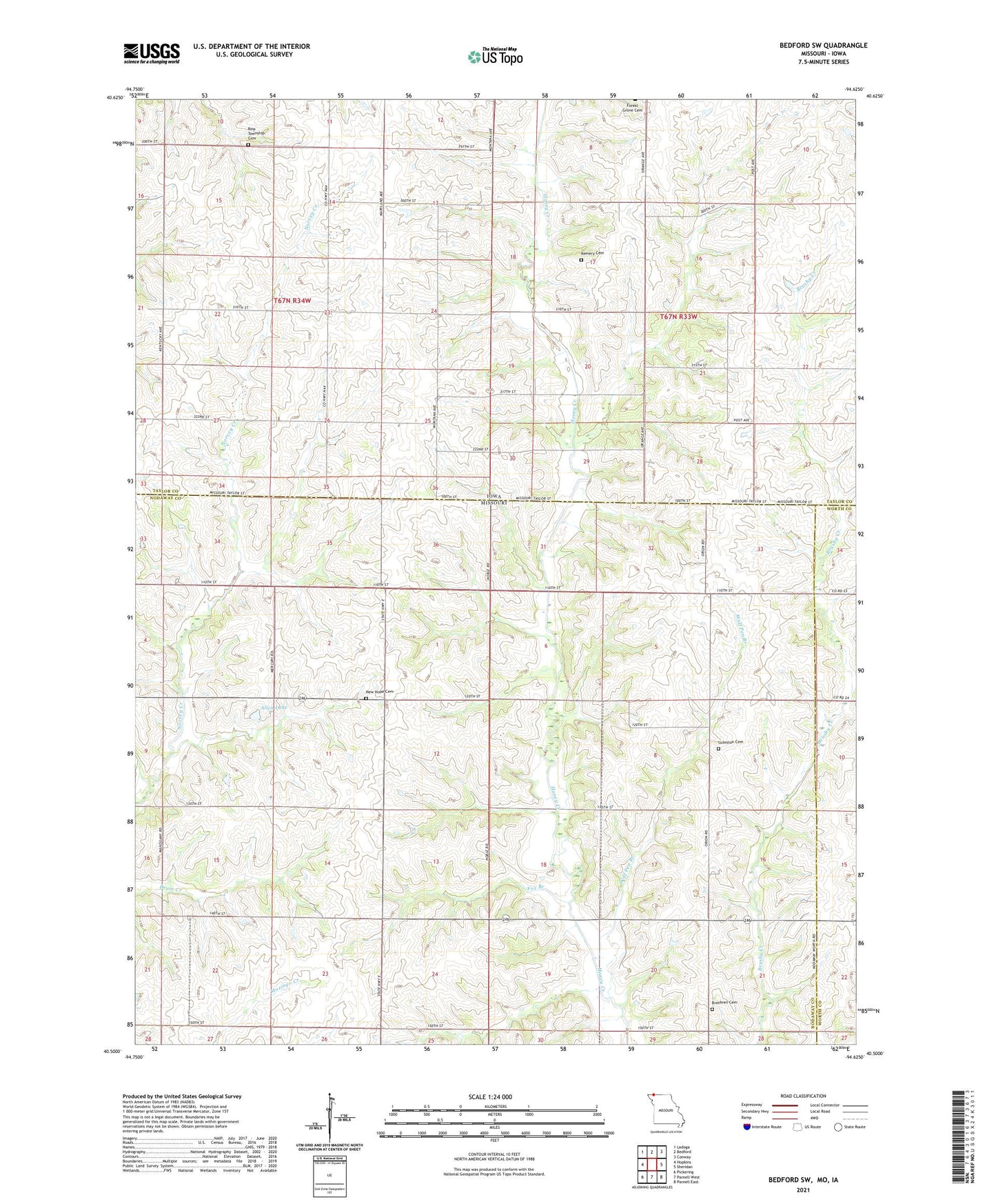
2021 topographic map quadrangle Bedford SW in the states of Missouri, Iowa. Scale: 1:24000. Based on the newly updated USGS 7.5' US Topo map series, this map is in the following counties: Nodaway, Taylor, Worth. The map contains contour data, water features, and other items you are used to seeing on USGS maps, but also has updated roads and other features. This is the next generation of topographic maps. Printed on high-quality waterproof paper with UV fade-resistant inks.
Quads adjacent to this one:
West: Hopkins
Northwest: Ladoga
North: Bedford
Northeast: Conway
East: Sheridan
Southeast: Parnell East
South: Parnell West
Southwest: Pickering
This map covers the same area as the classic USGS quad with code o40094e6.
Contains the following named places: Allen Lake, Allen Lake Dam, Allison, Allison Post Office, Berea Church, Brethren Cemetery, Enod Post Office, Foster School, Fox Branch, James Lake, James Lake Dam, Kemery Cemetery, Lone Star School, Luteston Cemetery, Luteston School, Maple Grove School, Mount Vernon School, New Hope Cemetery, Oak Grove School, Ovid, Risser School, Ross Township Cemetery, Star of the West School, Township of Jackson, Township of Ross, Wolf Pen Branch