MyTopo
Purdy Missouri US Topo Map
Couldn't load pickup availability
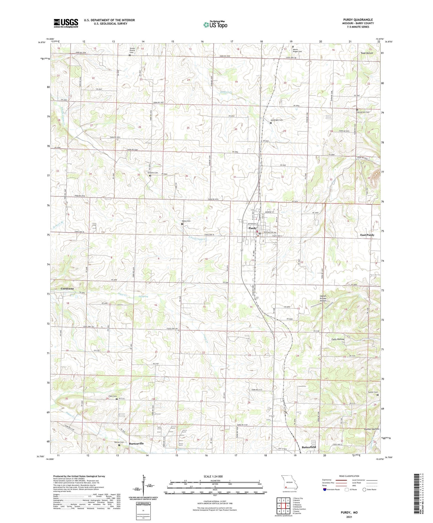
2021 topographic map quadrangle Purdy in the state of Missouri. Scale: 1:24000. Based on the newly updated USGS 7.5' US Topo map series, this map is in the following counties: Barry. The map contains contour data, water features, and other items you are used to seeing on USGS maps, but also has updated roads and other features. This is the next generation of topographic maps. Printed on high-quality waterproof paper with UV fade-resistant inks.
Quads adjacent to this one:
West: Wheaton
Northwest: Pierce City
North: Monett
Northeast: Verona
East: McDowell
Southeast: Cassville
South: Exeter
Southwest: Rocky Comfort
Contains the following named places: Arnhart Church, Arnhart School, Burton Cemetery, Burtonville, Butterfield, Central School, City of Purdy, Clark Cemetery, Clark School, Corsicana, Corsicana School, East Purdy, Eden School, Fly Spring, Gibbons Air Park, Goodnight Cemetery, Gunter Church, Gunter School, Henderson Cemetery, Henneman School, Hopedale School, Ingram Private Airport, Long School, Long View Church, Macedonia Church, Matty Cemetery, Mount Joy Church, Mount Pisgah Church, Mount Pleasant Church, New Salem Church, Ozark School, Pleasant Valley School, Purdy, Purdy Elementary School, Purdy Fire Protection District, Purdy High School, Purdy Middle School, Purdy Police Department, Purdy Post Office, Saint Johns Church, Saint Johns School, Stinnett Cemetery, Township of Corsicana, Township of Purdy, ZIP Code: 65734