MyTopo
Wheaton Missouri US Topo Map
Couldn't load pickup availability
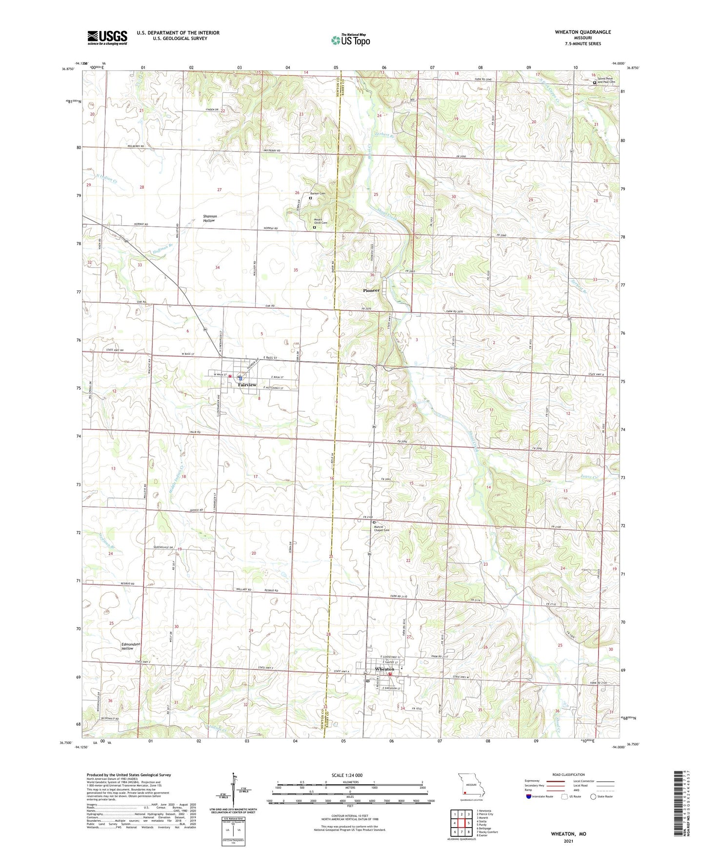
2021 topographic map quadrangle Wheaton in the state of Missouri. Scale: 1:24000. Based on the newly updated USGS 7.5' US Topo map series, this map is in the following counties: Barry, Newton. The map contains contour data, water features, and other items you are used to seeing on USGS maps, but also has updated roads and other features. This is the next generation of topographic maps. Printed on high-quality waterproof paper with UV fade-resistant inks.
Quads adjacent to this one:
West: Stella
Northwest: Newtonia
North: Pierce City
Northeast: Monett
East: Purdy
Southeast: Exeter
South: Rocky Comfort
Southwest: Bethpage
This map covers the same area as the classic USGS quad with code o36094g1.
Contains the following named places: Archibald School, Barker Cemetery, Big Spring School, Brown School, Camp Yo-Ko-Mo Bluff, City of Wheaton, Cloverdale School, Ergo, Fairview, Fairview Police Department, Fairview Post Office, Fairview Volunteer Fire Department, Fairview Volunteer Fire Protection Association, Grangeville, Green Ridge School, Johnson School, Joyce Creek, Monett Rural Fire Association Station 3, Mount Olive Cemetery, Mount Olive Church, Muncie Chapel, Muncie Chapel Cemetery, Newstead, Pioneer, Pioneer Census Designated Place, Pogue Creek, Pulaskifield, Saints Peter and Paul Cemetery, Sunrise, Swindle College School, Town of Fairview, Township of Pioneer, Township of Wheaton, Wheaton, Wheaton Elementary School, Wheaton Fire Protection District, Wheaton High School, Wheaton Post Office, Zerbert Branch, ZIP Codes: 64842, 64874