MyTopo
Pyrmont Missouri US Topo Map
Couldn't load pickup availability
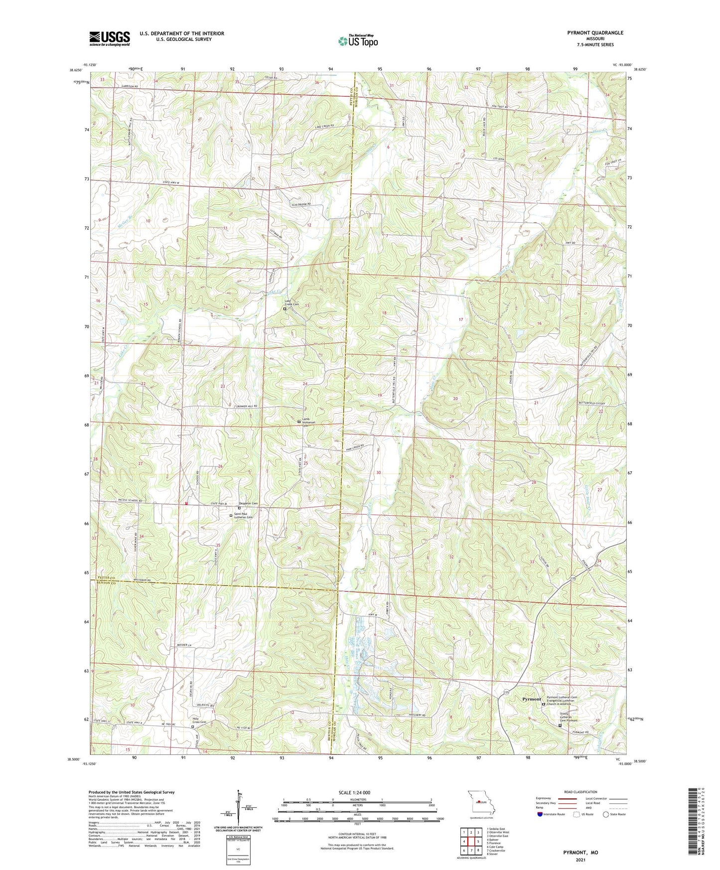
2021 topographic map quadrangle Pyrmont in the state of Missouri. Scale: 1:24000. Based on the newly updated USGS 7.5' US Topo map series, this map is in the following counties: Morgan, Pettis, Benton. The map contains contour data, water features, and other items you are used to seeing on USGS maps, but also has updated roads and other features. This is the next generation of topographic maps. Printed on high-quality waterproof paper with UV fade-resistant inks.
Quads adjacent to this one:
West: Bahner
Northwest: Sedalia East
North: Otterville West
Northeast: Otterville East
East: Florence
Southeast: Stover
South: Crockerville
Southwest: Cole Camp
Contains the following named places: Bebra, Black Jack School, Bunker Hill School, Holy Cross Cemetery, Lake Creek Cemetery, Lake Creek Church, Lake Creek Volunteer Fire Department, Lamb Immanuel Cemetery, Little Haw Creek, Lutman, Martens School, Oakland School, Pyrmont, Pyrmont Lutheran Cemetery - Evangelical Lutheran Church in America, Ringen School, Saint Paul Lutheran Cemetery, Township of Lake Creek, Trinity Lutheran Cemetery Pyrmont