MyTopo
Cole Camp Missouri US Topo Map
Couldn't load pickup availability
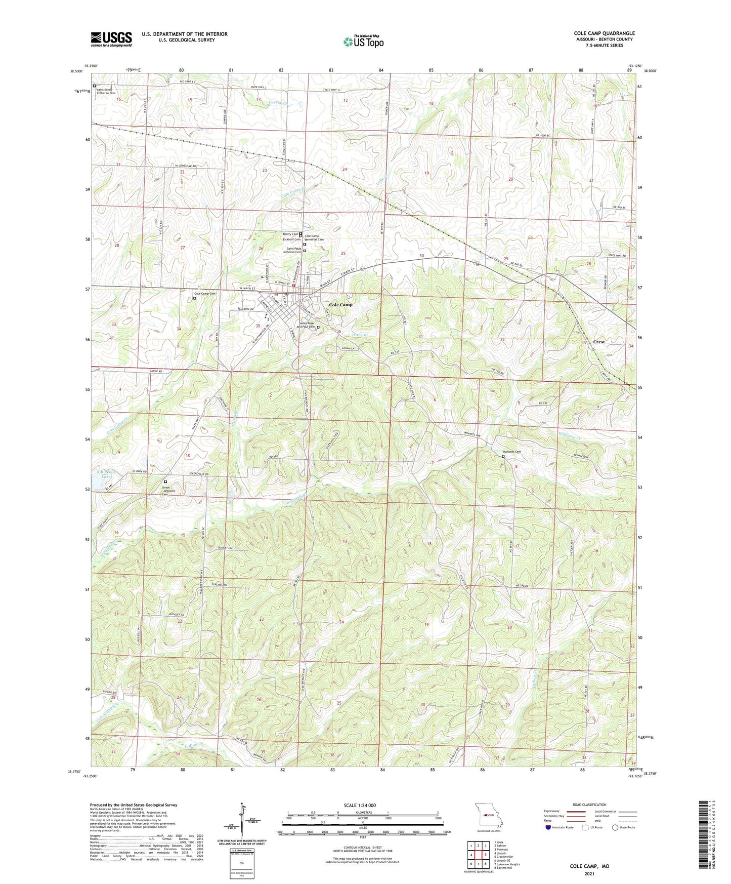
2021 topographic map quadrangle Cole Camp in the state of Missouri. Scale: 1:24000. Based on the newly updated USGS 7.5' US Topo map series, this map is in the following counties: Benton. The map contains contour data, water features, and other items you are used to seeing on USGS maps, but also has updated roads and other features. This is the next generation of topographic maps. Printed on high-quality waterproof paper with UV fade-resistant inks.
Quads adjacent to this one:
West: Lincoln
Northwest: Ionia
North: Bahner
Northeast: Pyrmont
East: Crockerville
Southeast: Boylers Mill
South: Lakeview Heights
Southwest: Lincoln SE
This map covers the same area as the classic USGS quad with code o38093d2.
Contains the following named places: B B Rekus Lake, City of Cole Camp, Cole Camp, Cole Camp and Rural Fire Protection District, Cole Camp Cemetery, Cole Camp Memorial Cemetery, Cole Camp Police Department, Cole Camp Post Office, Cole Camp Station, Crest, Eickhoff Cemetery, Fruend School, Hink School, Indian Creek, Kreisel School, Monsees Cemetery, Moss Lake Dam, Otten Branch, Rekus Lake Dam, Saint Johns Lutheran Cemetery, Saint Pauls Lutheran Cemetery, Saints Peter and Paul Cemetery, Township of Williams, Trinity Cemetery, Union - Williams Cemetery, Union Church, ZIP Code: 65325