MyTopo
Stover Missouri US Topo Map
Couldn't load pickup availability
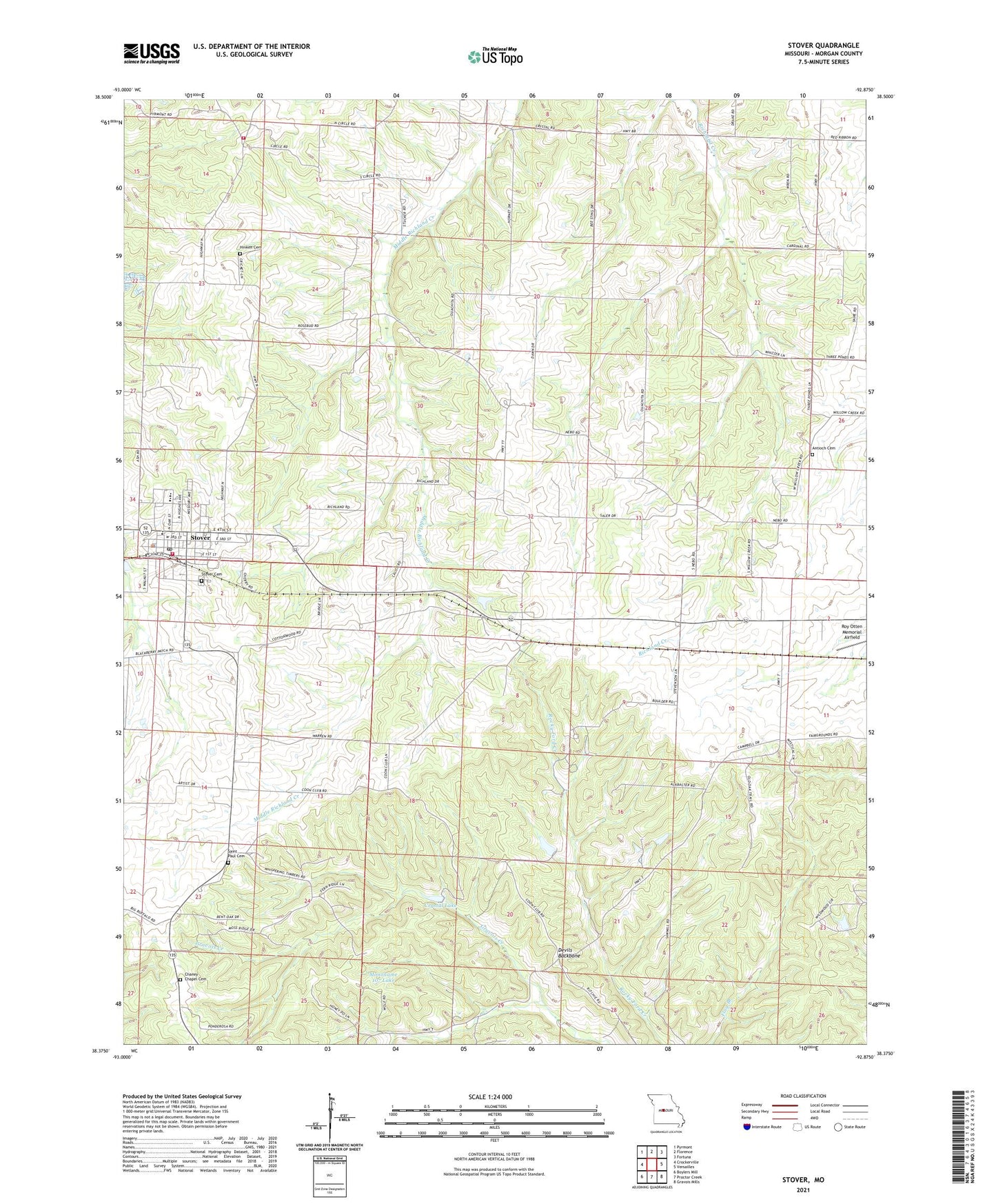
2021 topographic map quadrangle Stover in the state of Missouri. Scale: 1:24000. Based on the newly updated USGS 7.5' US Topo map series, this map is in the following counties: Morgan. The map contains contour data, water features, and other items you are used to seeing on USGS maps, but also has updated roads and other features. This is the next generation of topographic maps. Printed on high-quality waterproof paper with UV fade-resistant inks.
Quads adjacent to this one:
West: Crockerville
Northwest: Pyrmont
North: Florence
Northeast: Fortuna
East: Versailles
Southeast: Gravois Mills
South: Proctor Creek
Southwest: Boylers Mill
This map covers the same area as the classic USGS quad with code o38092d8.
Contains the following named places: Antioch Cemetery, Bethel School, Burkstresser School, Chaney Chapel Cemetery, City of Stover, Crystal Lake, Devils Backbone, Gabriel Mine, High Prairie School, Hinken Cemetery, Hinken School, Lodema, Mononame 107 Lake, Mononame 836 Dam, Morgan County, Mount Nebo Church, Pleasant Grove School, Post Oak School, Puachita, Ritchie School, Saint Paul Cemetery, Salmon School, Smiley School, Stover, Stover Cemetery, Stover Police Department, Stover Post Office, Stover Rural Fire Protection District Station 1, Stover Rural Fire Protection District Station 3, Township of Haw Creek, Wolf Den Mine