MyTopo
Raymore Missouri US Topo Map
Couldn't load pickup availability
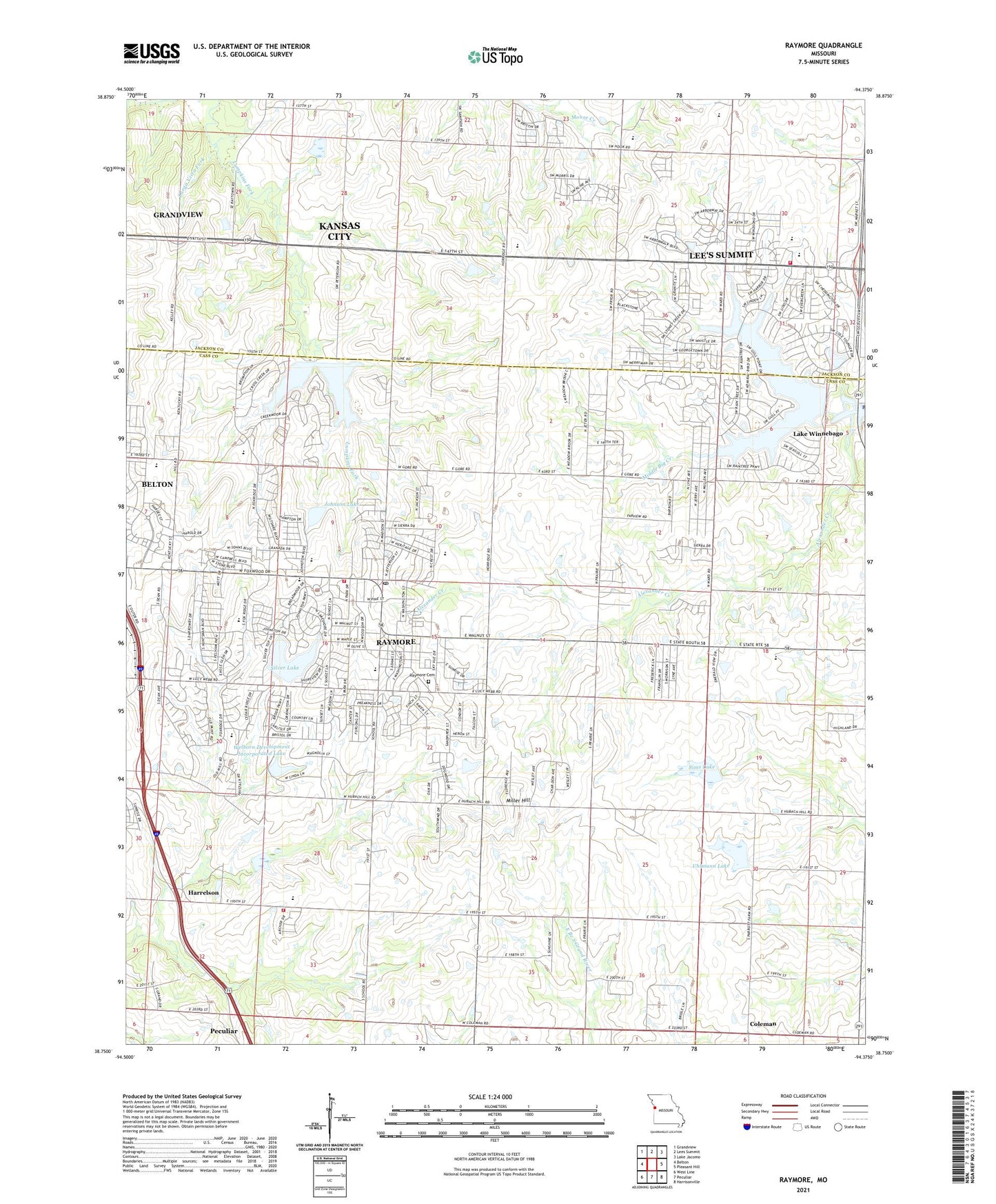
2021 topographic map quadrangle Raymore in the state of Missouri. Scale: 1:24000. Based on the newly updated USGS 7.5' US Topo map series, this map is in the following counties: Cass, Jackson. The map contains contour data, water features, and other items you are used to seeing on USGS maps, but also has updated roads and other features. This is the next generation of topographic maps. Printed on high-quality waterproof paper with UV fade-resistant inks.
Quads adjacent to this one:
West: Belton
Northwest: Grandview
North: Lees Summit
Northeast: Lake Jacomo
East: Pleasant Hill
Southeast: Harrisonville
South: Peculiar
Southwest: West Line
Contains the following named places: Alexander Creek, Bethany Church, Bridle Ridge Intermediate School, City of Raymore, Coleman, Creekmoor Elementary School, Delavan, Eagle Glen Intermediate School, Falcon Helipad, Harrelson, Hawthorn Hill Elementary School, High Mound School, Johnson Lake, Johnson Lake Dam, KCFX-FM (Harrisonville), Kentucky Trail Elementary School, Kinehaven Farm, KZKC-TV (Kansas City), Lake Winnebago Police Department, Larga Vista Fork, Lee's Summit Fire Department Station 5, Lee's Summit West High School, Miller Hill, Mononame 87 Dam, Mononame 88 Dam, Raintree Lake Dam, Raymore, Raymore Cemetery, Raymore Elementary School, Raymore International Airport, Raymore Junction, Raymore Police Department, Raymore Post Office, Rosedale School, Silver Lake, Silverlake Enterprizes Lake Dam, Sims Lake, Sims Lake Dam, South Metropolitan Fire Protection District Station 1, South Metropolitan Fire Protection District Station 3, Stonegate Elementary School, Summit Lakes Middle School, Summit Pointe Elementary School, Summit Ridge Academy, Timber Creek Elementary School, Township of Raymore, Trailridge Elementary School, Uhlmann Lake, Uhlmann Lake Dam, Welborn Development Incorporated Lake, Welborn Development Incorporated Lake Dam, ZIP Codes: 64082, 64083, 64149