MyTopo
Harrisonville Missouri US Topo Map
Couldn't load pickup availability
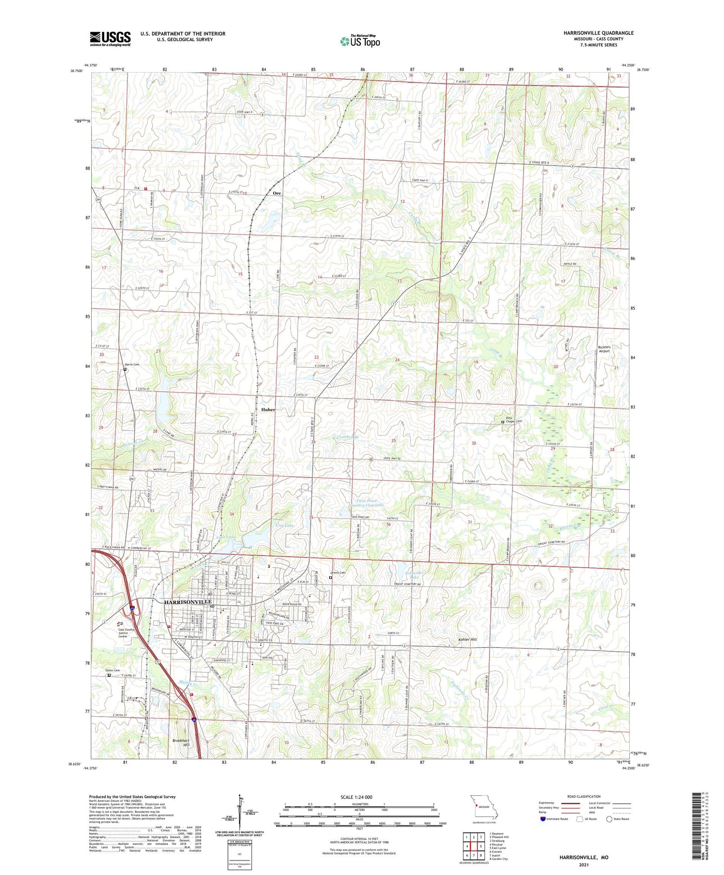
2021 topographic map quadrangle Harrisonville in the state of Missouri. Scale: 1:24000. Based on the newly updated USGS 7.5' US Topo map series, this map is in the following counties: Cass. The map contains contour data, water features, and other items you are used to seeing on USGS maps, but also has updated roads and other features. This is the next generation of topographic maps. Printed on high-quality waterproof paper with UV fade-resistant inks.
Quads adjacent to this one:
West: Peculiar
Northwest: Raymore
North: Pleasant Hill
Northeast: Strasburg
East: East Lynne
Southeast: Garden City
South: Austin
Southwest: Everett
This map covers the same area as the classic USGS quad with code o38094f3.
Contains the following named places: Bethel School, Briarwood School for the Severely Handicapped, Brookhart Hill, Cass County, Cass County Alternative School, Cass County Sheriff's Office, Centerview School, Central Cass County Fire Protection District Station 1, Central Cass County Fire Protection District Station 2, City Lake, City Lake Dam, City of Harrisonville, Country Creek Estates Golf Course, Country Creek Estates Wastewater Treatment Plant, Crooked Branch, Excelsior School, Glenn Cemetery, Hanesville Lake, Harris Cemetery, Harrisonville, Harrisonville Christian School, Harrisonville Early Childhood Center, Harrisonville Elementary School, Harrisonville Emergency Services, Harrisonville High School, Harrisonville Middle School, Harrisonville Police Department, Harrisonville Post Office, Harrisonville Schools Cass Career Center, Harrisonville Wastewater Treatment Plant, Huber, Kimpton, Knight School, Kohler Hill, Kohler Lake Dam, Lake Luna, Lake Luna Dam, Little Flock Church, Lone Elm School, McEowen Elementary School, Mount Zion School, North Lake, North Lake Dam, Oak Grove School, Ore, Orient Cemetery, Pitts Chapel Cemetery, Pleasant View Rest Home, Plum Grove School, Prairie Dell School, Richters Airport, Rock Island Lake, Rock Island Lake Dam, Schneider Lake, Schneider Lake Dam, Town Creek, Township of Peculiar, Twin Pines Country Club Lake, Twin Pines Country Club Lake Dam, Union Hall School, Walnut Grove School, Westchester Village Shopping Center