MyTopo
Hagers Grove Missouri US Topo Map
Couldn't load pickup availability
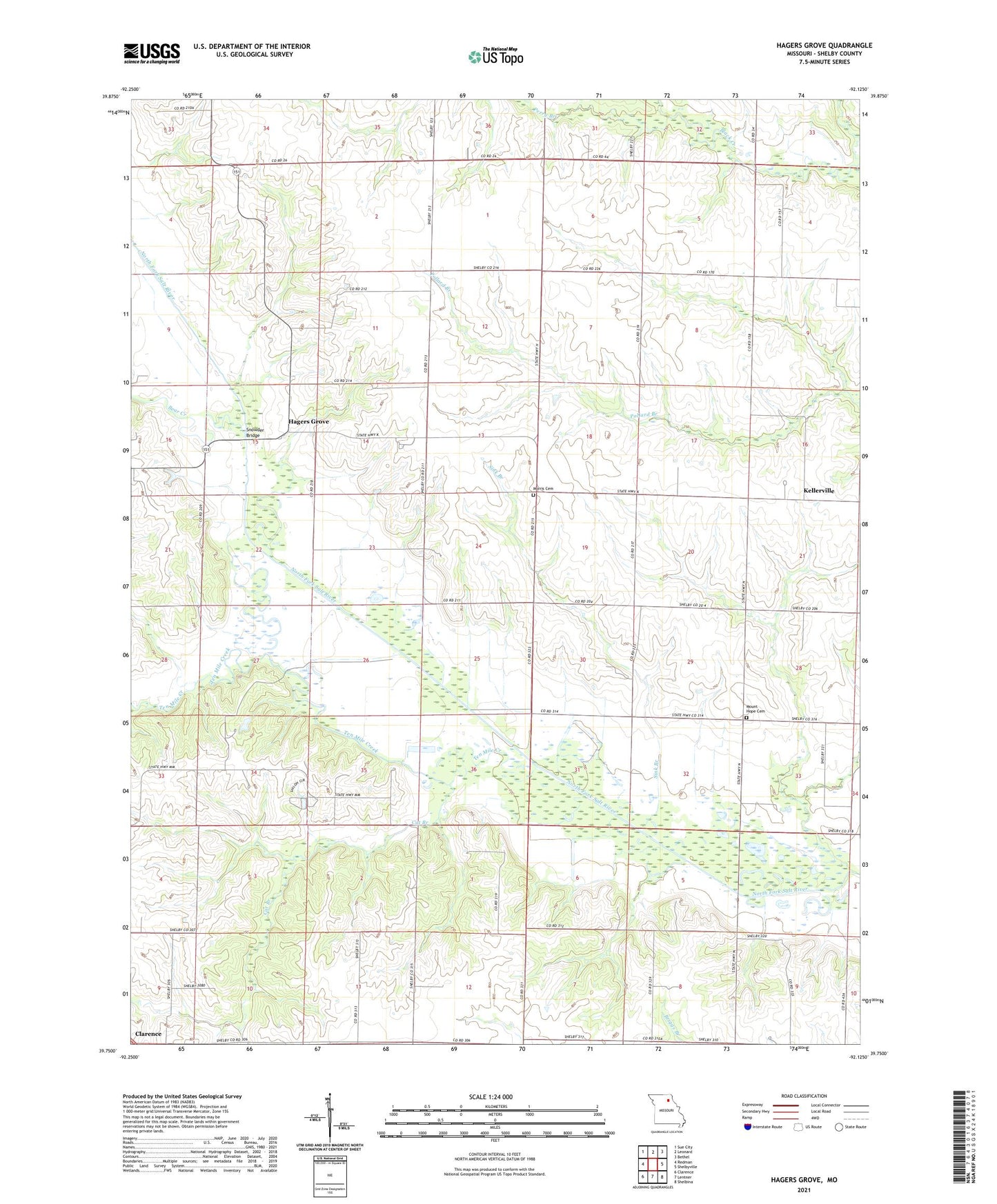
2021 topographic map quadrangle Hagers Grove in the state of Missouri. Scale: 1:24000. Based on the newly updated USGS 7.5' US Topo map series, this map is in the following counties: Shelby. The map contains contour data, water features, and other items you are used to seeing on USGS maps, but also has updated roads and other features. This is the next generation of topographic maps. Printed on high-quality waterproof paper with UV fade-resistant inks.
Quads adjacent to this one:
West: Redman
Northwest: Sue City
North: Leonard
Northeast: Bethel
East: Shelbyville
Southeast: Shelbina
South: Lentner
Southwest: Clarence
This map covers the same area as the classic USGS quad with code o39092g2.
Contains the following named places: Bacon Chapel, Bear Creek, Berea Church, Brewington School, Camp Jo-Ota, Camp Jo-Ota Lake Dam, Carrol Lake Dam, Cat Branch, Chick School, Copenhaver School, Enterprise School, Free Methodist Church, Hagers Grove, Hagers Grove Church, Hagers Grove Mill, Hagers Grove School, Kellerville, Leslie Evangelical Church, Morris Cemetery, Morris Chapel, Mount Hope Cemetery, Mount Hope Evangelical Lutheran Church, Mount Olive School, Mount Pleasant School, Patton Mill, Perry Branch, Red Star School, Saint Michael Church, Salt River Airport, Sink Branch, Snowder Bridge, Ten Mile Creek, Township of Clay