MyTopo
Lentner Missouri US Topo Map
Couldn't load pickup availability
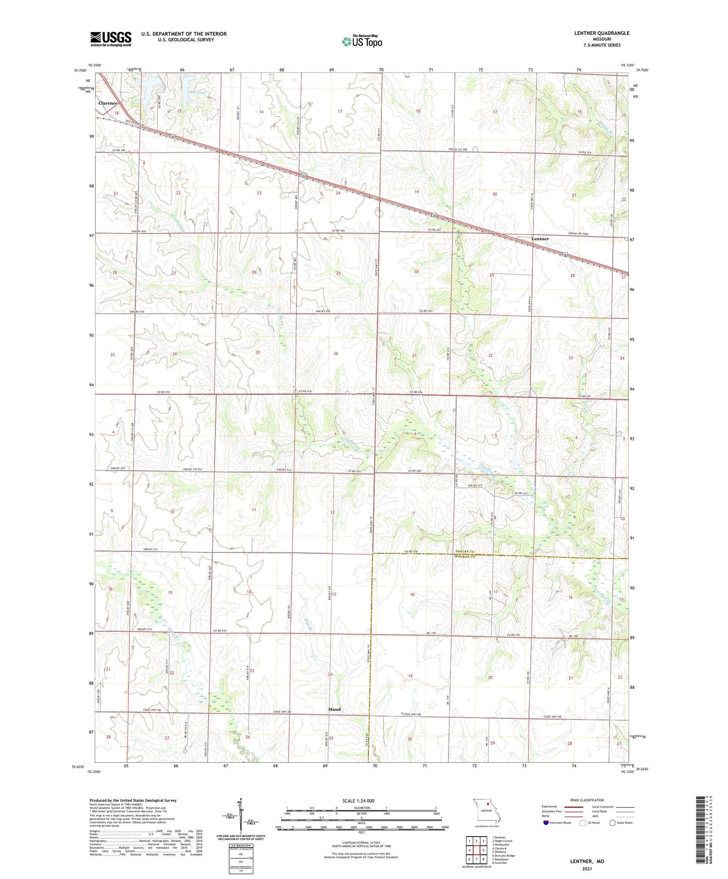
2021 topographic map quadrangle Lentner in the state of Missouri. Scale: 1:24000. Based on the newly updated USGS 7.5' US Topo map series, this map is in the following counties: Shelby, Monroe. The map contains contour data, water features, and other items you are used to seeing on USGS maps, but also has updated roads and other features. This is the next generation of topographic maps. Printed on high-quality waterproof paper with UV fade-resistant inks.
Quads adjacent to this one:
West: Clarence
Northwest: Redman
North: Hagers Grove
Northeast: Shelbyville
East: Shelbina
Southeast: Granville
South: Woodlawn
Southwest: Duncans Bridge
This map covers the same area as the classic USGS quad with code o39092f2.
Contains the following named places: Bishop School, Chinn School, Clarence City New Lake Dam, Clarence City Old Lake Dam, Clarence Lake, Fairview School, Lentner, L-Z Bravo Airport, Maud, Maud School, Oak Ridge Church, Oak Ridge School, Old Lake, Panhandle District, Stalcup School, Township of Jefferson, Township of Lentner, ZIP Codes: 63437, 63450