MyTopo
Olean Missouri US Topo Map
Couldn't load pickup availability
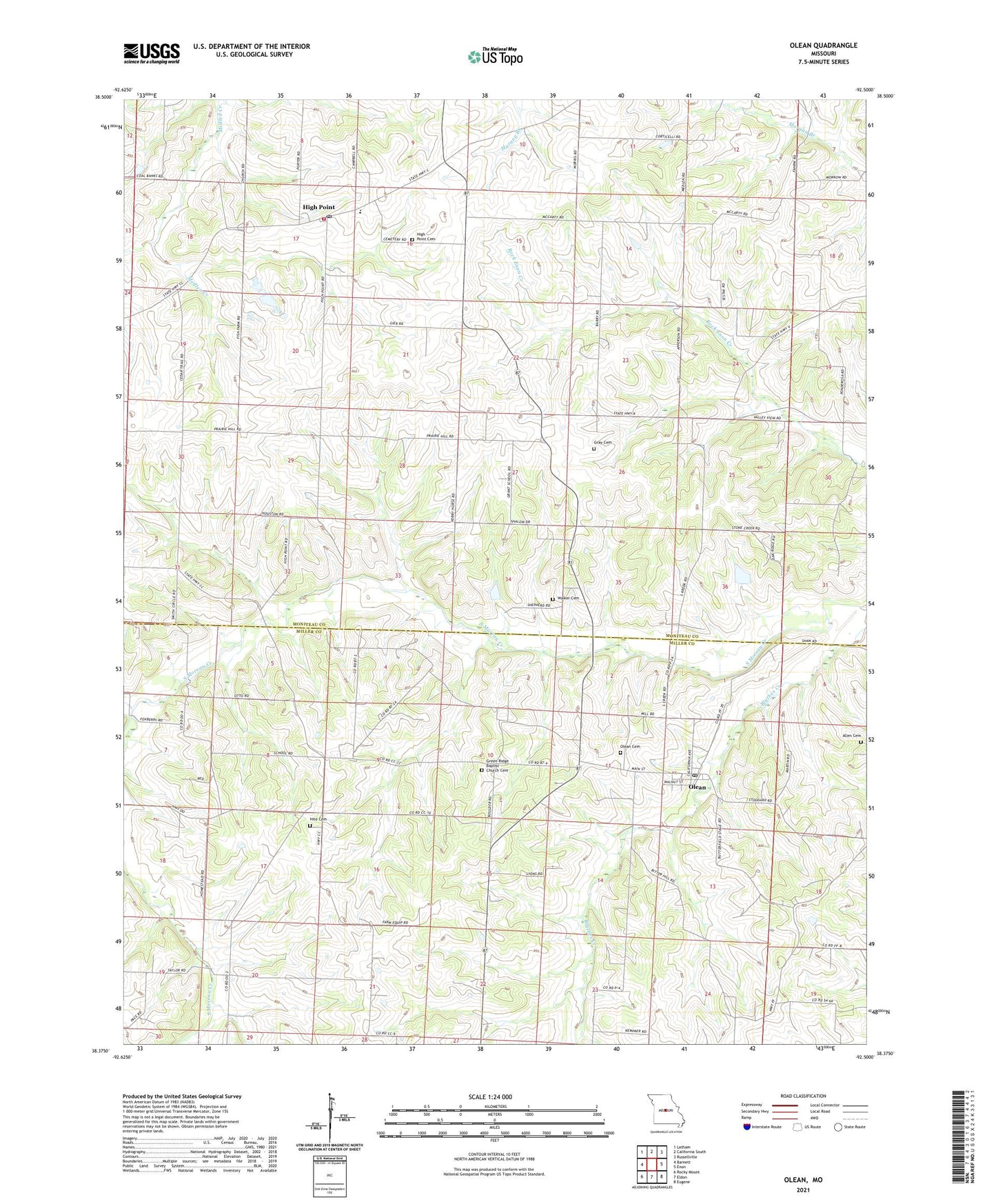
2021 topographic map quadrangle Olean in the state of Missouri. Scale: 1:24000. Based on the newly updated USGS 7.5' US Topo map series, this map is in the following counties: Moniteau, Miller. The map contains contour data, water features, and other items you are used to seeing on USGS maps, but also has updated roads and other features. This is the next generation of topographic maps. Printed on high-quality waterproof paper with UV fade-resistant inks.
Quads adjacent to this one:
West: Barnett
Northwest: Latham
North: California South
Northeast: Russellville
East: Enon
Southeast: Eugene
South: Eldon
Southwest: Rocky Mount
This map covers the same area as the classic USGS quad with code o38092d5.
Contains the following named places: Allen Cemetery, Beard Creek, Bond Lake Dam, California Rural Fire Protection District High Point Fire Station, Colburn Branch, Enon School, Goodmans, Grant School, Gray Cemetery, Green Ridge Baptist Church Cemetery, Green Ridge Church, High Point, High Point Cemetery, High Point Elementary School, Hite Cemetery, Lincoln School, Manning School, Olean, Olean Cemetery, Olean Post Office, Pleasant Mount, Prairie Hill School, Rock Enon Church, Sand Hill School, Sherman School, Taylor School, Tiff Mine, Town of Olean, Township of Harrison, Walker Cemetery