MyTopo
Lecoma Missouri US Topo Map
Couldn't load pickup availability
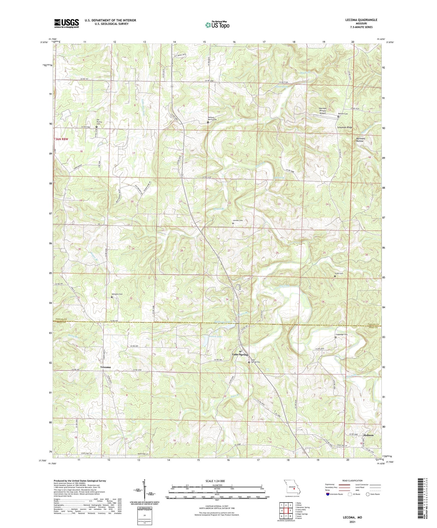
2021 topographic map quadrangle Lecoma in the state of Missouri. Scale: 1:24000. Based on the newly updated USGS 7.5' US Topo map series, this map is in the following counties: Phelps, Dent. The map contains contour data, water features, and other items you are used to seeing on USGS maps, but also has updated roads and other features. This is the next generation of topographic maps. Printed on high-quality waterproof paper with UV fade-resistant inks.
Quads adjacent to this one:
West: Yancy Mills
Northwest: Rolla
North: Dillon
Northeast: Maramec Spring
East: Seaton
Southeast: Salem
South: Anutt
Southwest: Edgar Springs
This map covers the same area as the classic USGS quad with code o37091g6.
Contains the following named places: Bell Spring, Benton Cemetery, Bubbling Springs Dam, Bubbling Springs Landing Strip, Carson Store, Central School, Coppage Bank, Coppedge Cemetery, Elk Prairie, Elk Prairie Cemetery, Elk Prairie Church, Elk Prairie School, Fabick Lake, Harrison Private Airport, Highway Lake, Highway Lake Dam, Hobson, Hyer Branch, KUMR-FM (Rolla), Lake Spring, Lecoma, Lecoma School, Lennox Cemetery, Linville School, Matlock - Morris Cemetery, Peters Branch, Primitive Church, Ragan Branch, Schuman Ridge, Scott Cemetery, Spring Hill School, Township of Cold Spring, Williams Cemetery, Wilson Spring, Wishon School