MyTopo
Sedalia West Missouri US Topo Map
Couldn't load pickup availability
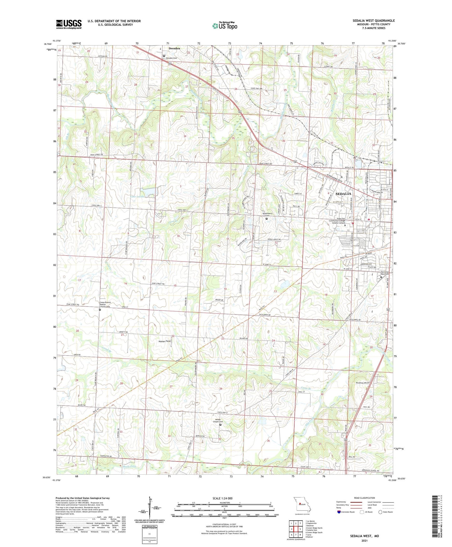
2021 topographic map quadrangle Sedalia West in the state of Missouri. Scale: 1:24000. Based on the newly updated USGS 7.5' US Topo map series, this map is in the following counties: Pettis. The map contains contour data, water features, and other items you are used to seeing on USGS maps, but also has updated roads and other features. This is the next generation of topographic maps. Printed on high-quality waterproof paper with UV fade-resistant inks.
Quads adjacent to this one:
West: Green Ridge North
Northwest: La Monte
North: Hughesville
Northeast: Beaman
East: Sedalia East
Southeast: Bahner
South: Ionia
Southwest: Green Ridge South
Contains the following named places: Anderson School, Basin Fork, Bradford Roadside Park, Brown School, Camp Branch, Camp Branch Church, Camp Branch School, Campbell Siding, Coon Creek, Department of Conservation Kansas City Regional Field Fire Office Sedalia, Dresden Cemetery, E W Thompson School for the Handicapped, Elk Branch, Glover School, High Point School, Homan Field, KDRO-AM (Sedalia), KMOS-TV (Sedalia), Lake Lucille, McKee Chapel, Memorial Park Cemetery, Oak Grove School, Parkhurst Lake Dam, Pettis County, Pettis County Elementary School, Pettis County Fire Protection District Station 1, Quisenberry Cemetery, Quisenberry School, Sedalia Fire Department Headquarters Station, Skyline Elementary School, State Fair Community College, State Fair Shopping Center, State Fairground Racetrack, Thompson Hills Shopping Center, Township of Prairie, Van Natta School, Walnut Hill Country Club