MyTopo
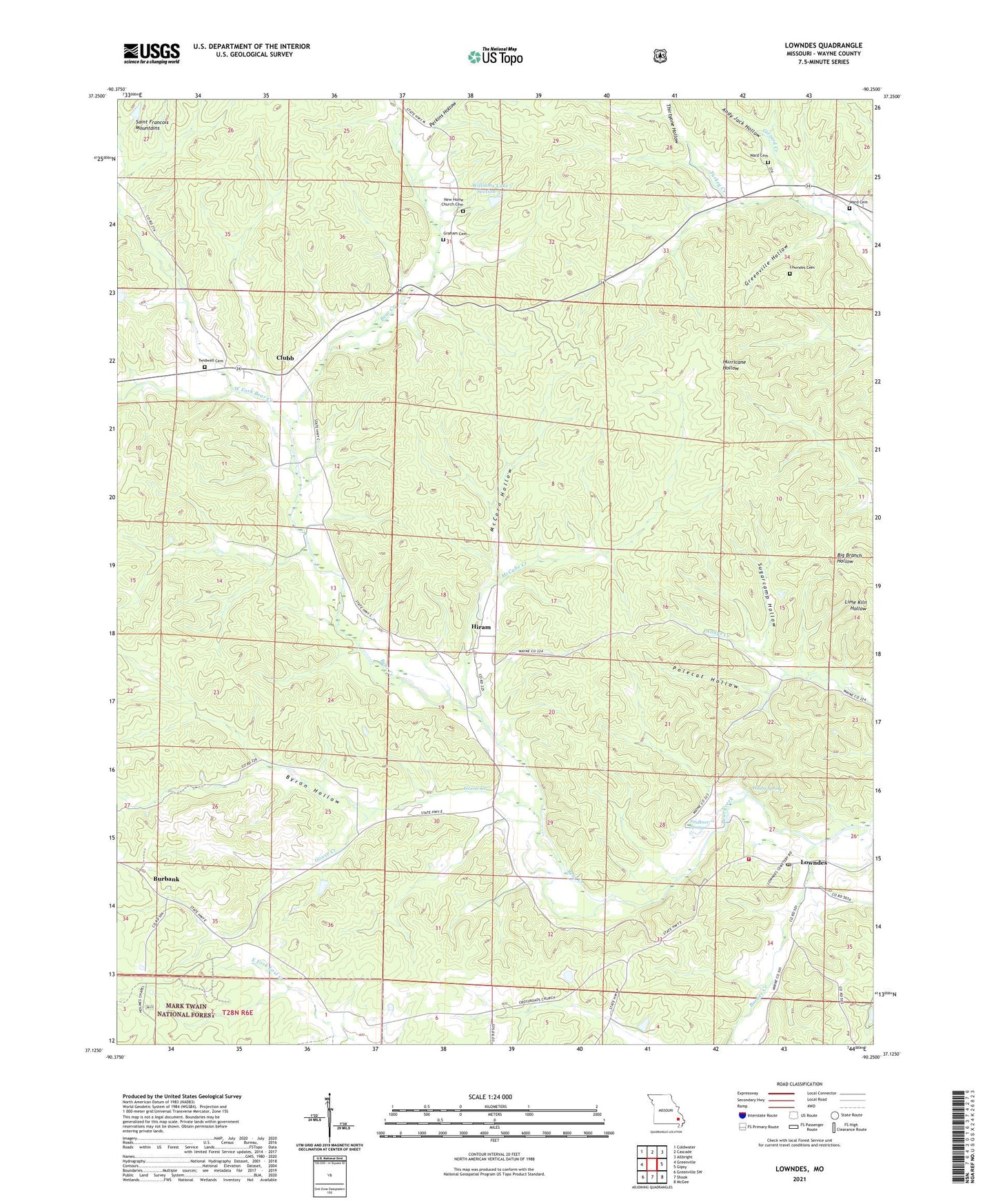
Lowndes Missouri US Topo Map
Couldn't load pickup availability
Also explore the Lowndes Forest Service Topo of this same quad for updated USFS data
2021 topographic map quadrangle Lowndes in the state of Missouri. Scale: 1:24000. Based on the newly updated USGS 7.5' US Topo map series, this map is in the following counties: Wayne. The map contains contour data, water features, and other items you are used to seeing on USGS maps, but also has updated roads and other features. This is the next generation of topographic maps. Printed on high-quality waterproof paper with UV fade-resistant inks.
Quads adjacent to this one:
West: Greenville
Northwest: Coldwater
North: Cascade
Northeast: Allbright
East: Gipsy
Southeast: McGee
South: Shook
Southwest: Greenville SW
This map covers the same area as the classic USGS quad with code o37090b3.
Contains the following named places: Anderson Lake, Anderson Lake Dam, Andy Jack Hollow, Barnes Creek, Burbank, Burbank School, Byron Hollow, Camp Number 30, Clubb, Clubb School, Coldwater State Forest, Crossroads Church, Faulkner Spring, Gizzard Creek, Goose Creek, Graham Cemetery, Greenville Hollow, Hickory Grove Church, Hiram, Hiram School, Hiram State Wildlife Management Area, Holmes Chapel, Holmes Chapel School, Hughs Spring, Lowndes, Lowndes Cemetery, Lowndes Post Office, Lowndes Volunteer Fire and Rescue, McCabe Creek, McCarn Hollow, New Home Church, Perkins Hollow, Polecat Hollow, Sugarcamp Hollow, Thirtyone Hollow, Township of Cowan, Twidwell Cemetery, Upper Turkey Creek Church, Upper Turkey Creek School, Ward Cemetery, Wesley Chapel, West Fork Bear Creek, Williams Lake Section 31, Williams Lake Section 31 Dam, ZIP Code: 63934