MyTopo
Stella Missouri US Topo Map
Couldn't load pickup availability
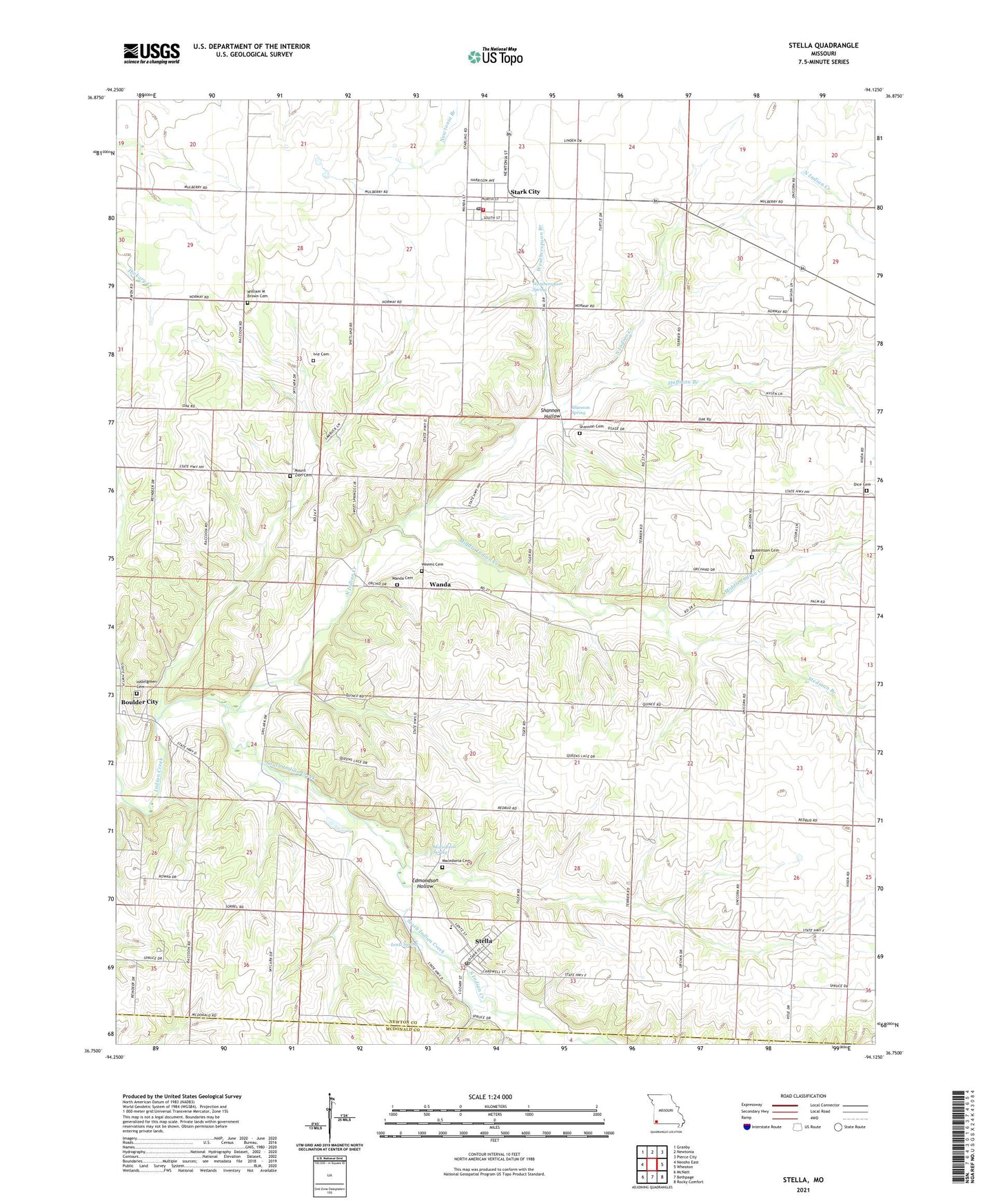
2021 topographic map quadrangle Stella in the state of Missouri. Scale: 1:24000. Based on the newly updated USGS 7.5' US Topo map series, this map is in the following counties: Newton, McDonald. The map contains contour data, water features, and other items you are used to seeing on USGS maps, but also has updated roads and other features. This is the next generation of topographic maps. Printed on high-quality waterproof paper with UV fade-resistant inks.
Quads adjacent to this one:
West: Neosho East
Northwest: Granby
North: Newtonia
Northeast: Pierce City
East: Wheaton
Southeast: Rocky Comfort
South: Bethpage
Southwest: McNatt
Contains the following named places: Boulder City, Cartmell, Chester, Dalbom Airport, Diamond Hall School, Dice Cemetery, Edmondson Hollow, Hazel Green School, Hazelgreen Cemetery, Huffman Branch, Independence School, Ivie Cemetery, Jones Chapel, Kenny Branch, Kent, Lentz Spring, Liberty School, Lone Star Church, Lone Star School, Macedonia Cemetery, Macedonia Spring, Middle Indian Creek, Midway School, Mount Zion Cemetery, North Indian Creek, Olivers Prairie, Oshkosh School, Robertson Cemetery, Shannon Cemetery, Shannon Hollow, Shannon Spring, South Indian Creek, Stark City, Stark City Post Office, Stark City Volunteer Fire Department, Stedman Branch, Stella, Stella Post Office, Stella Rural Volunteer Fire Department Station 3 Stella, Town of Stark City, Town of Stella, Township of Franklin, Township of Newtonia, Triway Elementary and Junior High School, Union School, Wadell, Wanda, Wanda Cemetery, Wanda School, Weatherspoon Branch, Weatherspoon Spring, Weems Cemetery, William M Brown Cemetery, ZIP Code: 64866