MyTopo
Neosho East Missouri US Topo Map
Couldn't load pickup availability
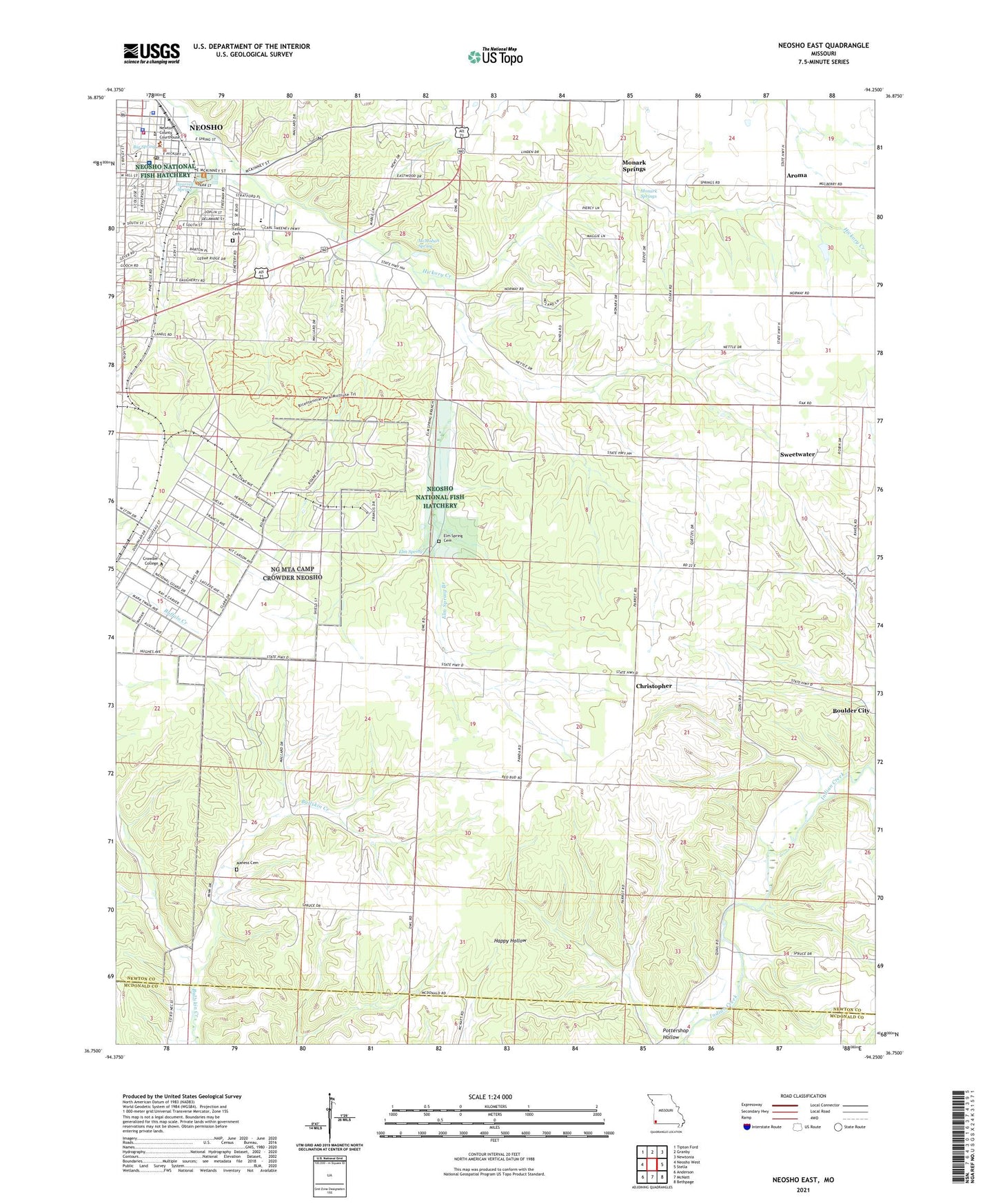
2021 topographic map quadrangle Neosho East in the state of Missouri. Scale: 1:24000. Based on the newly updated USGS 7.5' US Topo map series, this map is in the following counties: Newton, McDonald. The map contains contour data, water features, and other items you are used to seeing on USGS maps, but also has updated roads and other features. This is the next generation of topographic maps. Printed on high-quality waterproof paper with UV fade-resistant inks.
Quads adjacent to this one:
West: Neosho West
Northwest: Tipton Ford
North: Granby
Northeast: Newtonia
East: Stella
Southeast: Bethpage
South: McNatt
Southwest: Anderson
This map covers the same area as the classic USGS quad with code o36094g3.
Contains the following named places: Aroma, Benton Elementary School, Benton School, Big Spring, Big Spring Park, Camp Crowder, Central Elementary School, Christopher, Christopher School, City of Neosho, Cloverleaf School, Crowder College, Elm Spring, Elm Spring Branch, Elm Spring Cemetery, Five Points School, Freeman Neosho Hospital, Hearrell Spring, June, KBTN-AM (Neosho), Maness Cemetery, McMahan Spring, Monark Church, Monark School, Monark Springs, Morse Park, Neosho, Neosho Fire Department Station 1, Neosho National Fish Hatchery, Neosho Police Department, Neosho Post Office, Newton County Sheriff's Office, Oak Grove Church, Oakgrove School, Pleasant Valley School, Pottershop Hollow, School Number 93, Spring School, Stuffle Dam, Sweetwater, Township of Benton