MyTopo
Strasburg Missouri US Topo Map
Couldn't load pickup availability
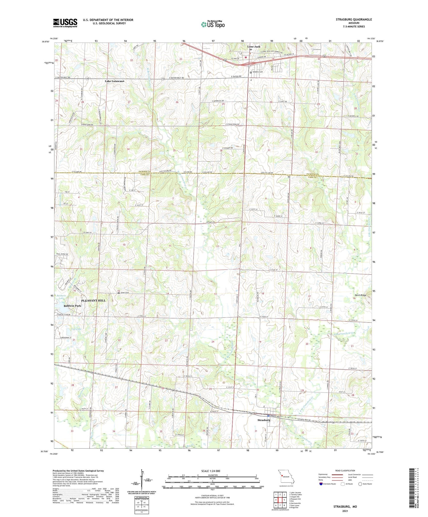
2021 topographic map quadrangle Strasburg in the state of Missouri. Scale: 1:24000. Based on the newly updated USGS 7.5' US Topo map series, this map is in the following counties: Cass, Jackson. The map contains contour data, water features, and other items you are used to seeing on USGS maps, but also has updated roads and other features. This is the next generation of topographic maps. Printed on high-quality waterproof paper with UV fade-resistant inks.
Quads adjacent to this one:
West: Pleasant Hill
Northwest: Lake Jacomo
North: Tarsney Lakes
Northeast: Chapel Hill
East: Elm
Southeast: Kingsville
South: East Lynne
Southwest: Harrisonville
Contains the following named places: Baldwin Dam, Baldwin Lake, Baldwin Park, Bee Hive School, City of Lone Jack, City of Strasburg, Duncan Branch, East Branch Crawford Creek, Hazel Grove School, Lone Jack, Lone Jack Fire Protection District, Lone Jack High School, Lone Jack Post Office, Lone Jack Primary School, Lone Pine Farm Lake Dam, Pleasant Grove School, Rising Star School, Rockhill School, Skaggs, Skaggs Post Office, Sloan Cemetery, Soldiers Cemetery, Strasburg, Strasburg Elementary School, Strasburg Police Department, Township of Polk, Van Lake, Village of Baldwin Park, West Branch Crawford Creek, ZIP Code: 64090