MyTopo
Sturgeon SW Missouri US Topo Map
Couldn't load pickup availability
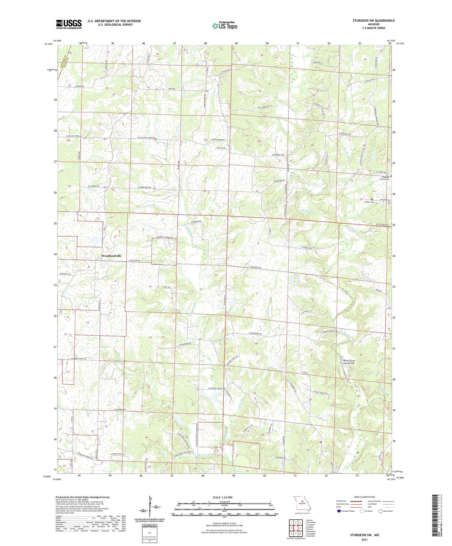
2021 topographic map quadrangle Sturgeon SW in the state of Missouri. Scale: 1:24000. Based on the newly updated USGS 7.5' US Topo map series, this map is in the following counties: Boone, Howard. The map contains contour data, water features, and other items you are used to seeing on USGS maps, but also has updated roads and other features. This is the next generation of topographic maps. Printed on high-quality waterproof paper with UV fade-resistant inks.
Quads adjacent to this one:
West: Hilldale
Northwest: Burton
North: Harrisburg
Northeast: Sturgeon
East: Browns
Southeast: Columbia
South: Huntsdale
Southwest: Rocheport
Contains the following named places: Barclay Branch, Bennett Lake Dam, Bethlehem Church, Bethlehem School, Boone County B-1 Dam, Boone County Fire Protection District Station 13, Botner Cemetery, Callahan Creek Watershed Dam A-1, Callahan Creek Watershed Dam A-4, Callahan Creek Watershed Dam A-6, Callahan Creek Watershed Dam C-1, Callahan Creek Watershed Dam C-2, Callahan School, Coats Lake, Dexter Lake Dam, Dripping Spring Cemetery, Everett, Everett School, Germantown, Hatton Chapel, Kimmy Lake Dam, Kreisel Lake Section 3 Dam, Lathrope School, Lewis Lake North Dam, Lexington, Little Leech Dam, Little Leech Lake, Littles Branch, Memar Lake, New Providence Church, Persia, Providence School, Red Rock Church, Reeder Creek, Richland School, Silver Fork, Slacks Branch, Stapletown, Township of Perche, White Cloud Flying Field, Woodlandville, ZIP Code: 65256