MyTopo
Sue City Missouri US Topo Map
Couldn't load pickup availability
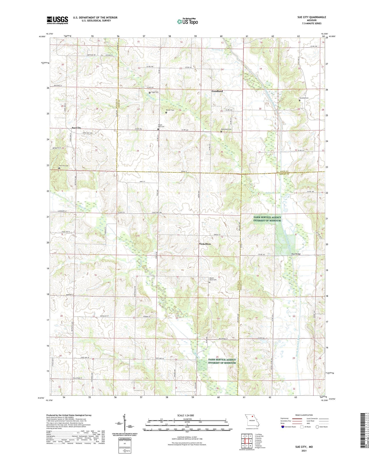
2021 topographic map quadrangle Sue City in the state of Missouri. Scale: 1:24000. Based on the newly updated USGS 7.5' US Topo map series, this map is in the following counties: Macon, Knox, Shelby. The map contains contour data, water features, and other items you are used to seeing on USGS maps, but also has updated roads and other features. This is the next generation of topographic maps. Printed on high-quality waterproof paper with UV fade-resistant inks.
Quads adjacent to this one:
West: Atlanta
Northwest: La Plata
North: Locust Hill
Northeast: Novelty
East: Leonard
Southeast: Hagers Grove
South: Redman
Southwest: Axtell
Contains the following named places: Bear Creek Church, Bear Creek School, Blanchard Cemetery, Bowan Cemetery, Cupp Cemetery, Eucebia Cemetery, Eucebia Church, Goodland, Hazel Dell Cemetery, Hazel Dell Church, Hazel Dell School, Lakeland, Luxor, McCully School, Moody School, Mount Olive Cemetery, Mount Olive Church, Mount Salem Church, Nickellton, Nickellton School, Rays Bridge, Saling Branch, Stones School, Sue City, Sue City Cemetery, Sue City Community Hall, Township of Jackson, Township of Johnston, Township of Salt River, Twomile Creek, Union School