MyTopo
Tipton Missouri US Topo Map
Couldn't load pickup availability
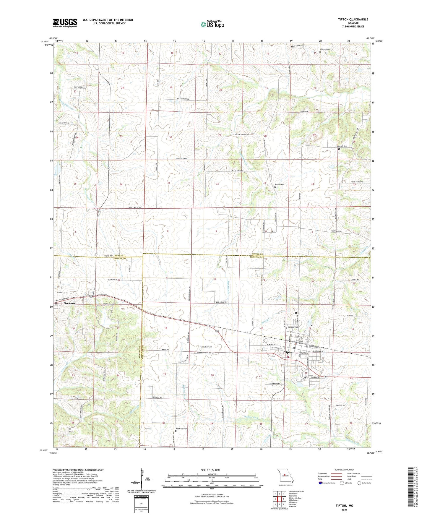
2021 topographic map quadrangle Tipton in the state of Missouri. Scale: 1:24000. Based on the newly updated USGS 7.5' US Topo map series, this map is in the following counties: Cooper, Moniteau, Morgan. The map contains contour data, water features, and other items you are used to seeing on USGS maps, but also has updated roads and other features. This is the next generation of topographic maps. Printed on high-quality waterproof paper with UV fade-resistant inks.
Quads adjacent to this one:
West: Otterville East
Northwest: Pilot Grove South
North: Bunceton
Northeast: Lone Elm
East: Clarksburg
Southeast: Latham
South: Fortuna
Southwest: Florence
Contains the following named places: Baxter School, Chilton Cemetery, City of Tipton, Clark School, Donley School, Excelsior School, Gallagher Cemetery, Gilroy School, Glendale School, Hirst, Hopewell Cemetery, Langkop Lake Dam, Lone Elm School, Masonic Cemetery, Olive Branch School, Smith Branch, Snorgrass Cemetery, Syracuse, Syracuse Post Office, Tipton, Tipton Correctional Center, Tipton Elementary School, Tipton Fire Department, Tipton High School, Tipton Police Department, Tipton Post Office, Township of Kelly, Vermont, Veulemans Lake Dam, Willow Fork School, Woods Cemetery, ZIP Codes: 65081, 65354