MyTopo
Truxton Missouri US Topo Map
Couldn't load pickup availability
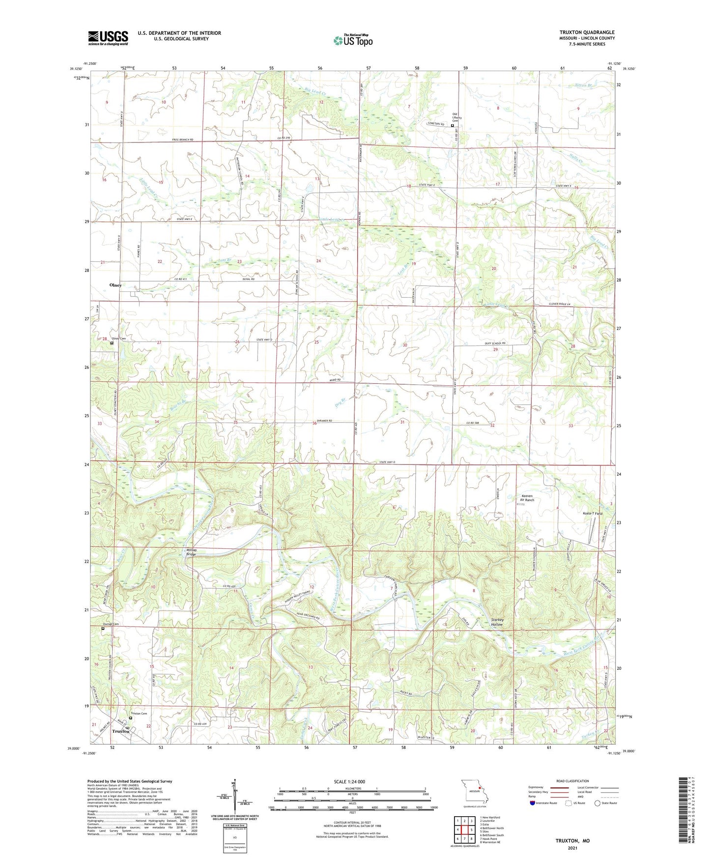
2021 topographic map quadrangle Truxton in the state of Missouri. Scale: 1:24000. Based on the newly updated USGS 7.5' US Topo map series, this map is in the following counties: Lincoln. The map contains contour data, water features, and other items you are used to seeing on USGS maps, but also has updated roads and other features. This is the next generation of topographic maps. Printed on high-quality waterproof paper with UV fade-resistant inks.
Quads adjacent to this one:
West: Bellflower North
Northwest: New Hartford
North: Louisville
Northeast: Eolia
East: Silex
Southeast: Warrenton NE
South: Hawk Point
Southwest: Bellflower South
Contains the following named places: Abe Duff School, Bear Creek, Beck School, Blair, Bracht Branch, Camp Creek, Duncan School, Fairview, Fairview Church, Fairview Post Office, Grimmett School, Keeven Air Ranch, Koala-T Field, Lost Branch, Millsap Bridge, Millsup Ford, Old Liberty Cemetery, Olney, Olney Cemetery, Owings Cemetery, Palmer School, Patterson School, Pine Knott School, Reddish School, Rocky Point School, Starkey Hollow, Township of Nineveh, Township of Prairie, Truxton, Truxton Cemetery, Truxton Post Office, Truxton School, Village of Truxton, ZIP Code: 63370