MyTopo
Unionville West Missouri US Topo Map
Couldn't load pickup availability
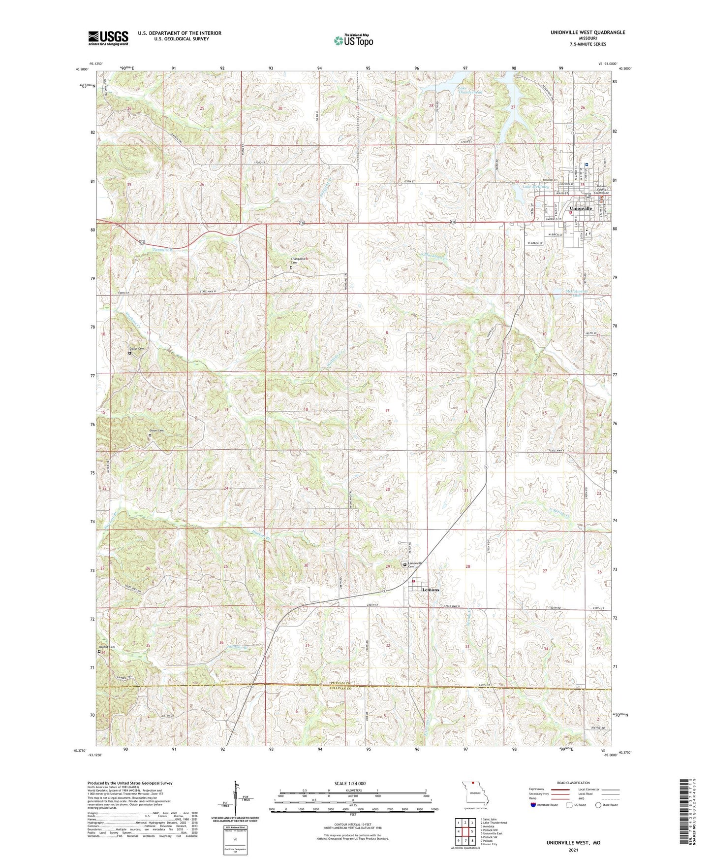
2021 topographic map quadrangle Unionville West in the state of Missouri. Scale: 1:24000. Based on the newly updated USGS 7.5' US Topo map series, this map is in the following counties: Putnam, Sullivan. The map contains contour data, water features, and other items you are used to seeing on USGS maps, but also has updated roads and other features. This is the next generation of topographic maps. Printed on high-quality waterproof paper with UV fade-resistant inks.
Quads adjacent to this one:
West: Pollock NW
Northwest: Saint John
North: Lake Thunderhead
Northeast: Mendota
East: Unionville East
Southeast: Green City
South: Pollock
Southwest: Pollock SW
Contains the following named places: Baptist Cemetery, Bethany Church, City of Unionville, Crumpacker Cemetery, Cullor Cemetery, Dixon Cemetery, Douglas School, Good Hope School, Grant School, Hand School, Keene School, Lake McKinley, Lemons, Lemons Census Designated Place, Lemons Rural Volunteer Fire Department, Lemonville Cemetery, Loughead School, McCalments Dam, McCalments Lake, Means School, Missouri Department of Conservation Forestry Northeast Regional Field Fire Office Unionville, Putnam County, Putnam County Memorial Hospital, Putnam County Sheriff's Office, Tanyard Branch, Township of Wilson, Triumph School, Unionville, Unionville Old City Lake Dam, Unionville Police Department, Unionville Post Office, Unionville Reservoir, Unionville Volunteer Fire Department, Vaughn School