MyTopo
Vichy Missouri US Topo Map
Couldn't load pickup availability
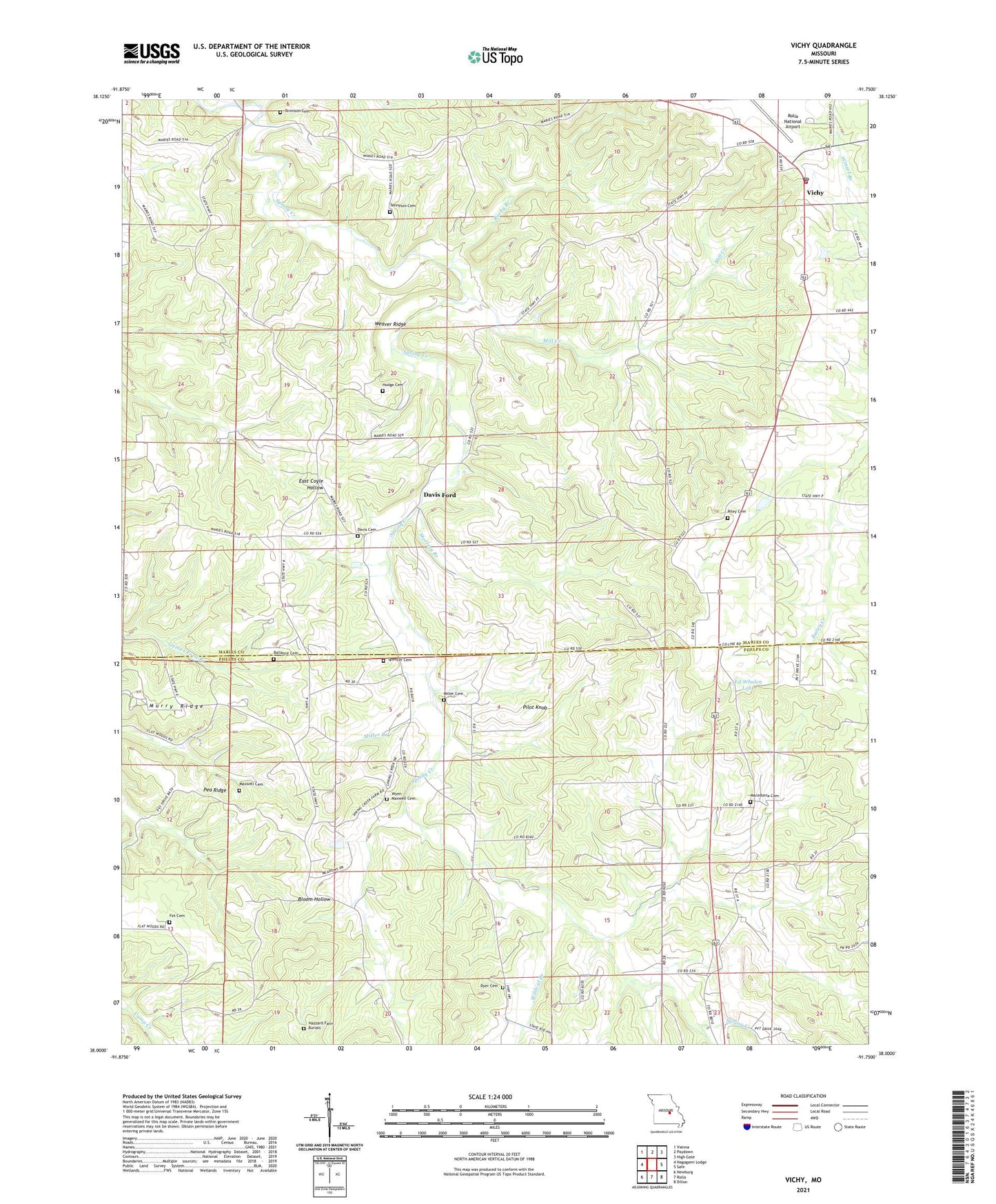
2021 topographic map quadrangle Vichy in the state of Missouri. Scale: 1:24000. Based on the newly updated USGS 7.5' US Topo map series, this map is in the following counties: Maries, Phelps. The map contains contour data, water features, and other items you are used to seeing on USGS maps, but also has updated roads and other features. This is the next generation of topographic maps. Printed on high-quality waterproof paper with UV fade-resistant inks.
Quads adjacent to this one:
West: Nagogami Lodge
Northwest: Vienna
North: Paydown
Northeast: High Gate
East: Safe
Southeast: Dillon
South: Rolla
Southwest: Newburg
Contains the following named places: Bailey Church, Ballance Cemetery, Cadmus, Davis Cemetery, Davis Church, Davis Ford, Davis School, Dyer Cemetery, Ed Whalen Lake, Feeler School, Fet Cemetery, Hazzard Farm Burials, Hodge Cemetery, Little Spring Creek, Macedonia, Macedonia Cemetery, Macedonia Church, Macedonia School, Maxwell Cemetery, Mill Creek, Miller Branch, Miller Cemetery, Miller School, Morresy Branch, Murry Ridge, Pea Ridge, Pilot Knob, Pleasant Ridge School, Riley Cemetery, Rocky Branch, Signal, Spencer Cemetery, Spring Creek Church, Tennison Cemetery, Tennison School, Tennyson Cemetery, Township of Miller, Township of Spring Creek, Veto, Vichy, Vichy Post Office, Vichy Volunteer Fire Department, Weaver Ridge, Wildcat Branch, Wo He Lo Woods Camp, Wynn - Maxwell Cemetery, Wynn Church, ZIP Code: 65580