MyTopo
Safe Missouri US Topo Map
Couldn't load pickup availability
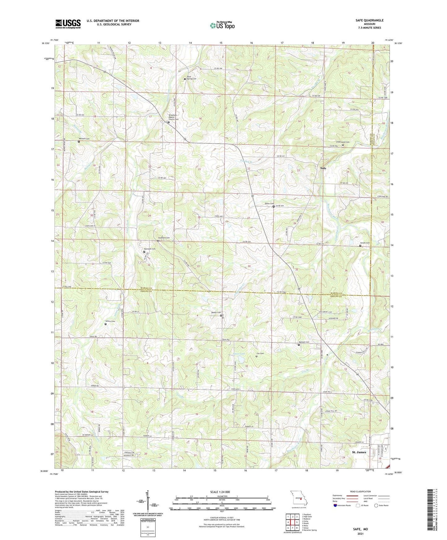
2021 topographic map quadrangle Safe in the state of Missouri. Scale: 1:24000. Based on the newly updated USGS 7.5' US Topo map series, this map is in the following counties: Maries, Phelps. The map contains contour data, water features, and other items you are used to seeing on USGS maps, but also has updated roads and other features. This is the next generation of topographic maps. Printed on high-quality waterproof paper with UV fade-resistant inks.
Quads adjacent to this one:
West: Vichy
Northwest: Paydown
North: High Gate
Northeast: Redbird
East: Rosati
Southeast: Maramec Spring
South: Dillon
Southwest: Rolla
This map covers the same area as the classic USGS quad with code o38091a6.
Contains the following named places: Amos Lake, Amos Lake Dam, Bailey Creek, Barnwell Cemetery, Beeler Cemetery, Broadway, Broadway Church, Broadway Post Office, Coppedge Creek, Cox Branch, Cox Cemetery, Dillon Cemetery, Dillon Lake Dam, Essie Dam, Ferndale School, High Grove School, Highgrove, I-38 Lake, Lacy School, Light, Matlock Cemetery, Matlock School, Northern Ozark Border, Pentecostal Church, Pleasant Grove School, Robinson Creek, Rock Spring Cemetery, Safe, Sellers Cemetery, Sewell Cemetery, Southard Cemetery, Star School, Township of Johnson, Underwood Cemetery, Union School, Vernon Dillon Lake, Vichy Campground Church, Wentzel Cemetery, Winsel Branch