MyTopo
High Gate Missouri US Topo Map
Couldn't load pickup availability
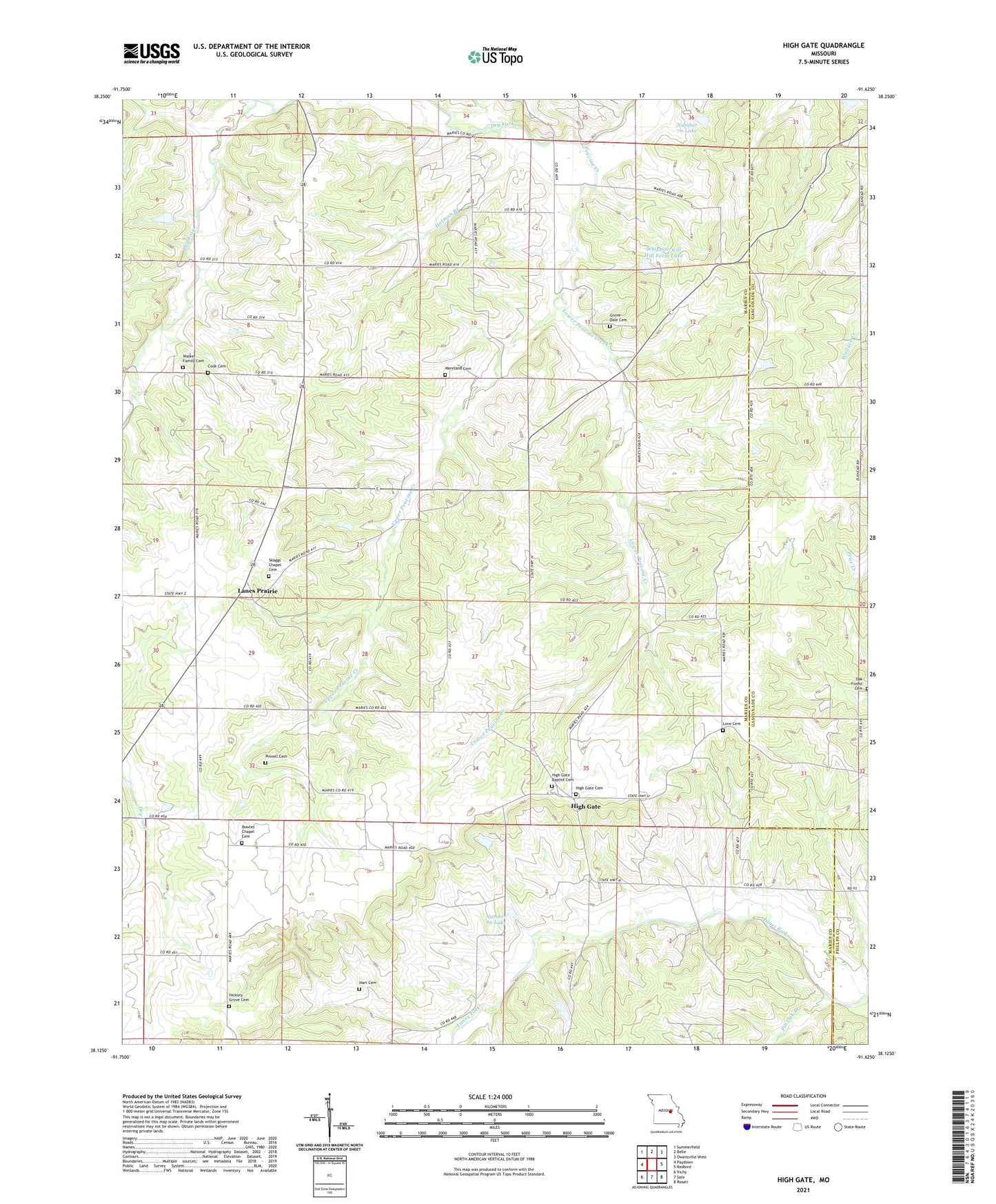
2021 topographic map quadrangle High Gate in the state of Missouri. Scale: 1:24000. Based on the newly updated USGS 7.5' US Topo map series, this map is in the following counties: Maries, Gasconade, Phelps. The map contains contour data, water features, and other items you are used to seeing on USGS maps, but also has updated roads and other features. This is the next generation of topographic maps. Printed on high-quality waterproof paper with UV fade-resistant inks.
Quads adjacent to this one:
West: Paydown
Northwest: Summerfield
North: Belle
Northeast: Owensville West
East: Redbird
Southeast: Rosati
South: Safe
Southwest: Vichy
This map covers the same area as the classic USGS quad with code o38091b6.
Contains the following named places: Bowles Chapel Cemetery, Cook Cemetery, Cowan Lake Dam, Dixie School, East Fairview School, Grove Dale Cemetery, Grovedale, Grovedale Church, Grovedale School, Harrison Center School, Hart Cemetery, Hickory Grove Cemetery, Hickory Grove Church, Hidden Lake Dam, High Gate, High Gate Cemetery, Hoffmann Lake Dam, Holman Branch, Lanes Prairie, Love Cemetery, Lower Peavine Creek, Moreland Cemetery, Number 69 Lake, Number 70 Lake, Oak Forest Cemetery, Peavine Creek, Pin Oak Branch, Shinkles School, Skaggs Chapel, Slinkman Lake Dam, Township of Jefferson, Upper Peavine Creek, Walker Family Cemetery, Wensler Lake Dam, Whippoorwill Hill Farm Lake, Whippoorwill Lake Dam, Yarna