MyTopo
Elkton Missouri US Topo Map
Couldn't load pickup availability
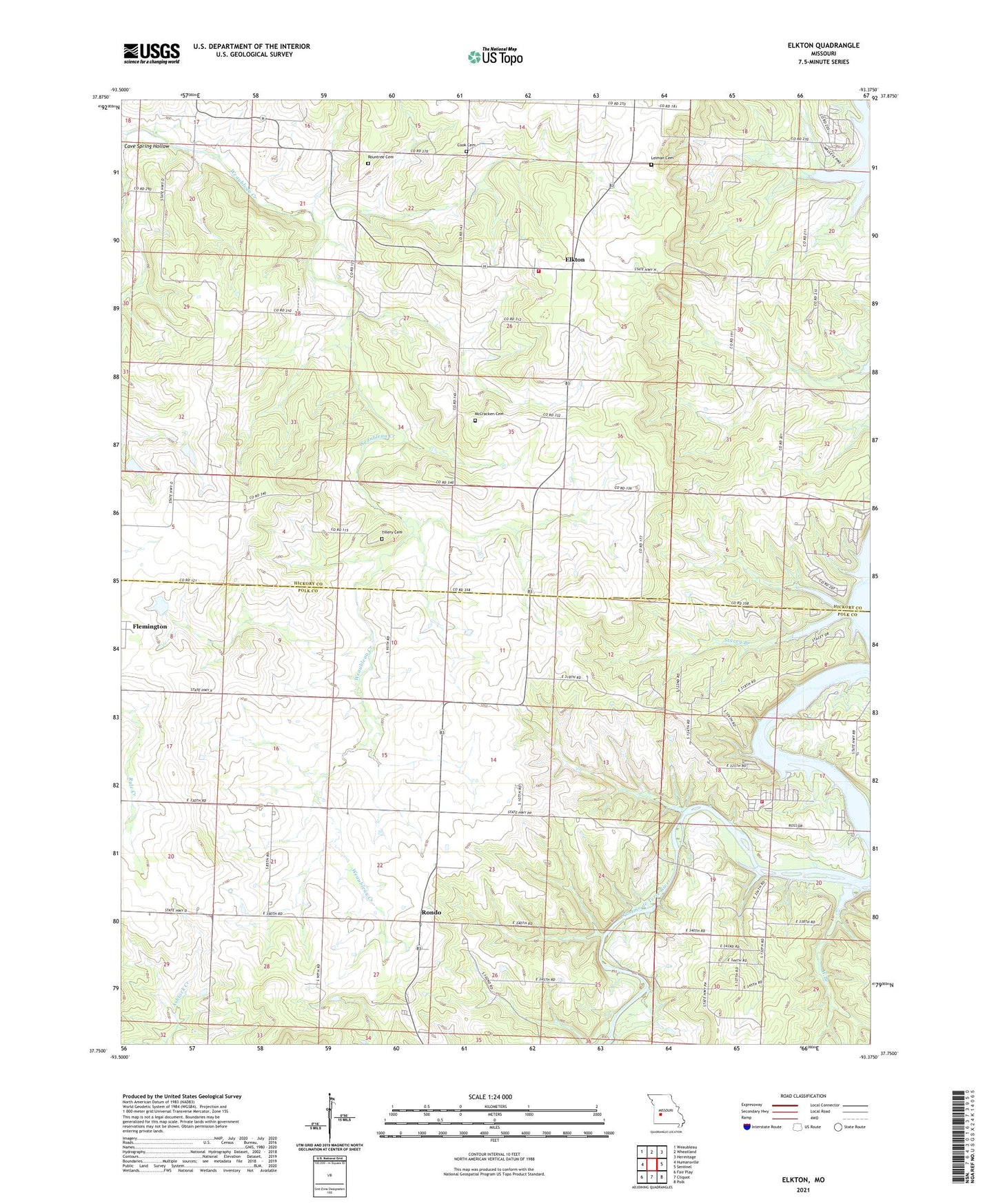
2021 topographic map quadrangle Elkton in the state of Missouri. Scale: 1:24000. Based on the newly updated USGS 7.5' US Topo map series, this map is in the following counties: Hickory, Polk. The map contains contour data, water features, and other items you are used to seeing on USGS maps, but also has updated roads and other features. This is the next generation of topographic maps. Printed on high-quality waterproof paper with UV fade-resistant inks.
Quads adjacent to this one:
West: Humansville
Northwest: Weaubleau
North: Wheatland
Northeast: Hermitage
East: Sentinel
Southeast: Polk
South: Cliquot
Southwest: Fair Play
This map covers the same area as the classic USGS quad with code o37093g4.
Contains the following named places: Bolivar Public Use Area, Cave Spring Hollow, Cook Cemetery, Durnell Chapel, Elkton, Elkton School, Fairview School, Green Grove School, Horn Hollow, Humansville Fire and Rescue Station 2, Leiman Cemetery, Mashburn School, McCracken Cemetery, Mission Chapel, Prairie Valley School, Rondo, Rondo School, Rountree Cemetery, Royal School, Shady Grove School, Stacey Branch, Sunny Slope School, Tillery Cemetery, Township of Jefferson, Township of Tyler, Union School, Vanderford Number Three Dam, Vanderford Number Two Dam, West Branch, Wheatland Volunteer Fire Department Elkton Station 2, ZIP Code: 65650