MyTopo
Windsor Missouri US Topo Map
Couldn't load pickup availability
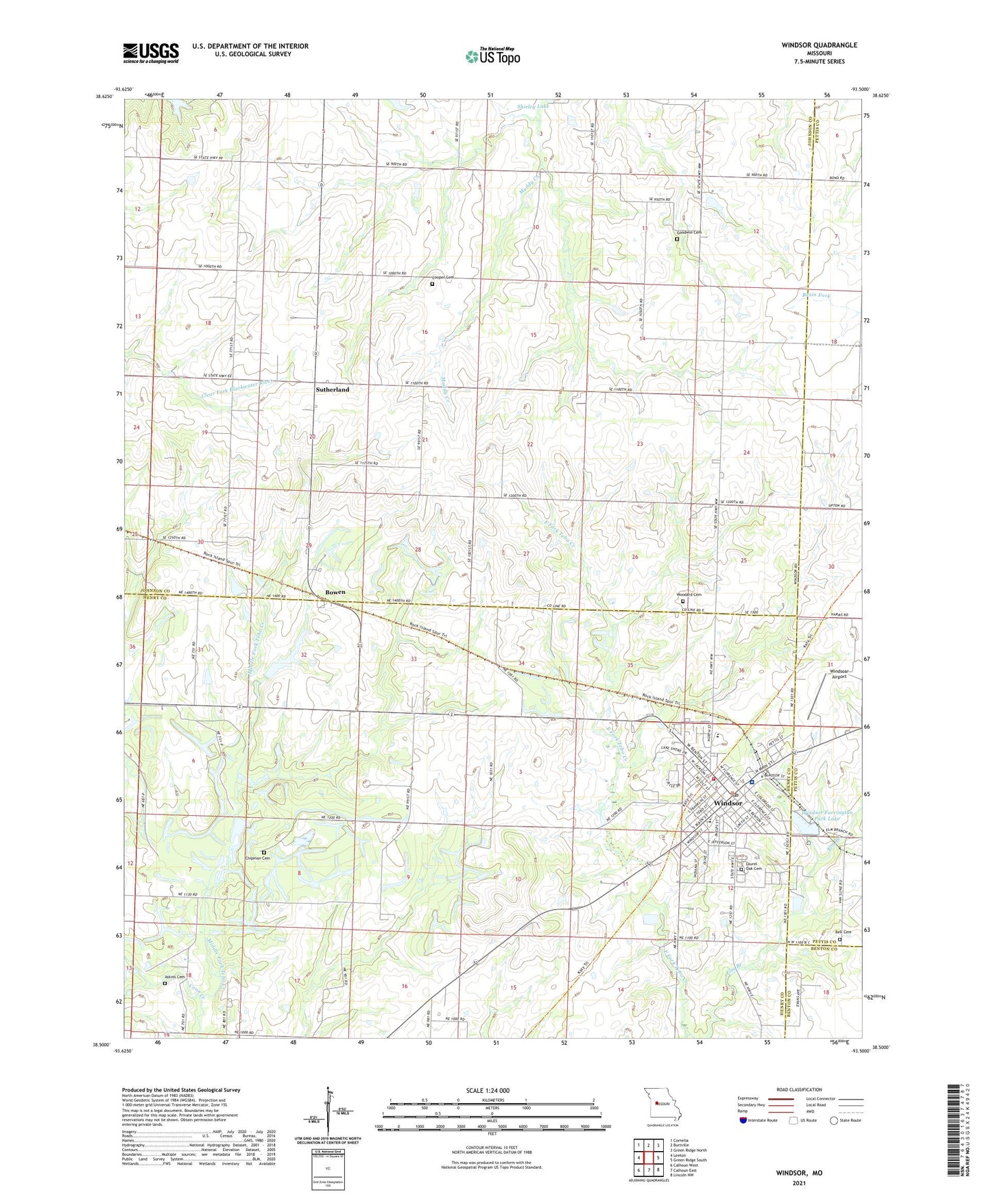
2021 topographic map quadrangle Windsor in the state of Missouri. Scale: 1:24000. Based on the newly updated USGS 7.5' US Topo map series, this map is in the following counties: Johnson, Henry, Pettis, Benton. The map contains contour data, water features, and other items you are used to seeing on USGS maps, but also has updated roads and other features. This is the next generation of topographic maps. Printed on high-quality waterproof paper with UV fade-resistant inks.
Quads adjacent to this one:
West: Leeton
Northwest: Cornelia
North: Burtville
Northeast: Green Ridge North
East: Green Ridge South
Southeast: Lincoln NW
South: Calhoun East
Southwest: Calhoun West
Contains the following named places: Askins Cemetery, Barber Lake Section 31 Dam, Barber Lake Section 32 Dam, Bell Cemetery, Berry School, Big Coal Bank, Bowen, Callaway Lake Dam, Chipman Cemetery, City of Windsor, Coon Creek, Cooper Cemetery, Elm Branch, Farrington Park, Ferguson Farms Airport, Goodwin Cemetery, Henrietta, Henrietta Post Office, High Point Church, Hillside School, Hughes School, Laurel Oak Cemetery, Liberty Church, Netsch Lake Dam, Pleasant Green School, Royal Oaks Hospital, Sunny Side School, Sutherland, Township of Jefferson, Township of Windsor, Valley Grove School, Windsoar Airport, Windsor, Windsor Elementary School, Windsor Fairground, Windsor Farrington Park Lake, Windsor Farrington Park Lake Dam, Windsor Four County Rural Fire Department, Windsor High School, Windsor Post Office, Woodard Cemetery, Young Lake Dam, ZIP Code: 65360