MyTopo
Fordham Missouri US Topo Map
Couldn't load pickup availability
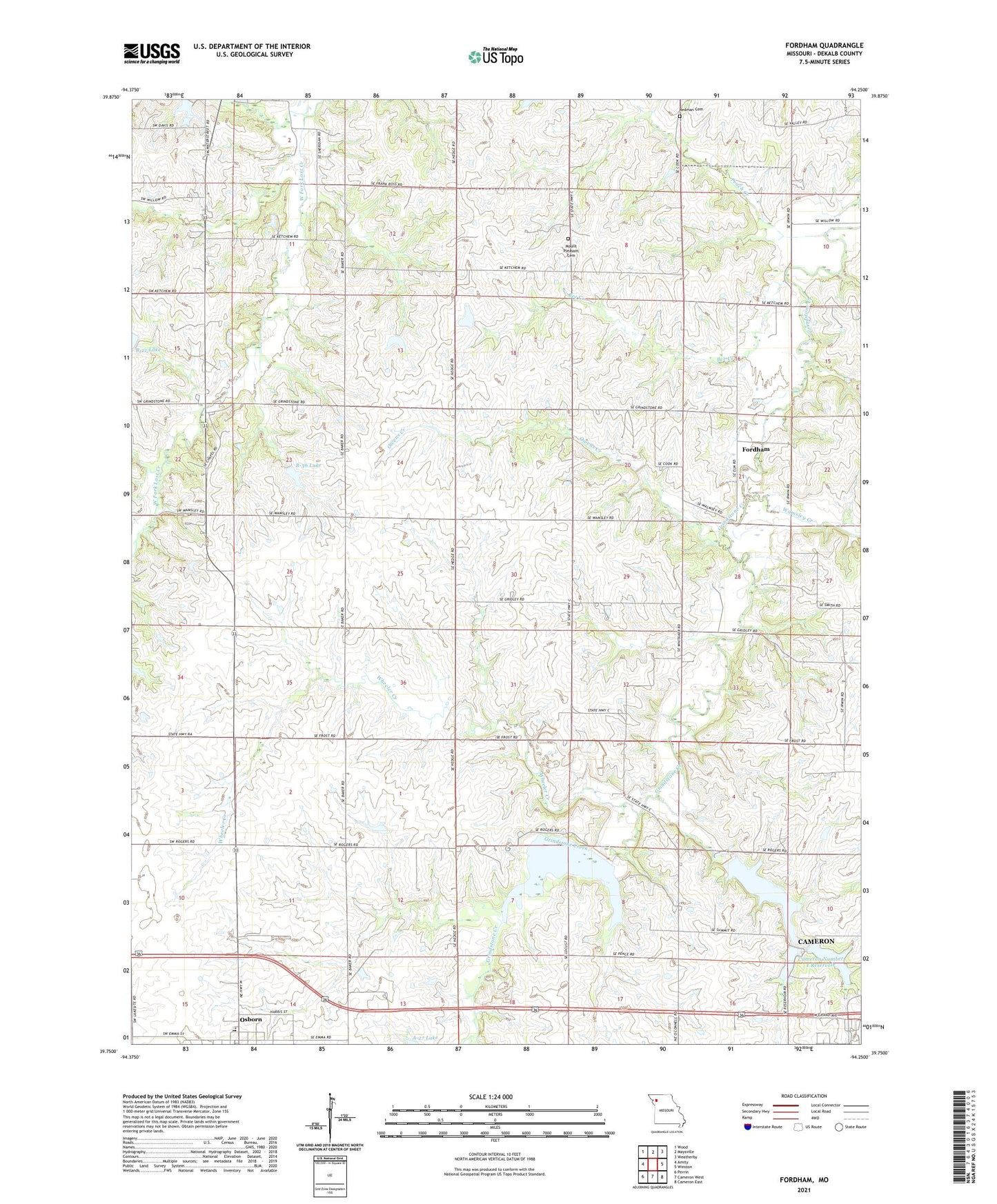
2021 topographic map quadrangle Fordham in the state of Missouri. Scale: 1:24000. Based on the newly updated USGS 7.5' US Topo map series, this map is in the following counties: DeKalb. The map contains contour data, water features, and other items you are used to seeing on USGS maps, but also has updated roads and other features. This is the next generation of topographic maps. Printed on high-quality waterproof paper with UV fade-resistant inks.
Quads adjacent to this one:
West: Amity
Northwest: Wood
North: Maysville
Northeast: Weatherby
East: Winston
Southeast: Cameron East
South: Cameron West
Southwest: Perrin
This map covers the same area as the classic USGS quad with code o39094g3.
Contains the following named places: A-27 Lake, A-39 Lake, B-36 Lake, Baker School, Bee Creek, Cameron Number 1 Reservoir, Cameron Reservoir Dam, Cameron Reservoir Number 2, Cameron Reservoir Number 2 Dam, Cameron Reservoir Number 3, Cameron Reservoirs, City of Cameron Reservoir Number 1 Dam, Fordham, Garden Prairie School, Gridley, Grindstone-Lost-Muddy Creek Watershed Dam A-39, Grindstone-Lost-Muddy Creek Watershed Dam B-25, Grindstone-Lost-Muddy Creek Watershed Dam B-35, Hedge School, Highland School, Liberty School, Marvin Chapel, Mount Pleasant Cemetery, Mount Pleasant Church, Osborn Elementary School, Osborn High School, Owens Creek, Peach Creek, Pleasant Valley School, Redman Cemetery, Redman Lake Dam, Summit School, Surprise School, Township of Grand River, Walnut Grove School, Wamsley Creek, Wheeler Creek