MyTopo
Woodlawn Missouri US Topo Map
Couldn't load pickup availability
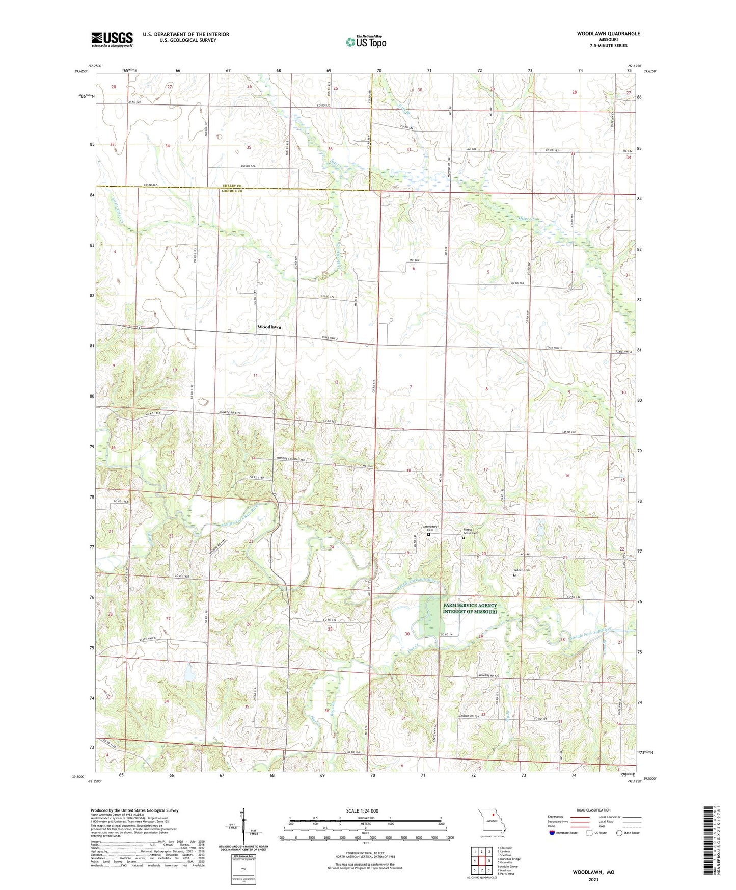
2021 topographic map quadrangle Woodlawn in the state of Missouri. Scale: 1:24000. Based on the newly updated USGS 7.5' US Topo map series, this map is in the following counties: Monroe, Shelby. The map contains contour data, water features, and other items you are used to seeing on USGS maps, but also has updated roads and other features. This is the next generation of topographic maps. Printed on high-quality waterproof paper with UV fade-resistant inks.
Quads adjacent to this one:
West: Duncans Bridge
Northwest: Clarence
North: Lentner
Northeast: Shelbina
East: Granville
Southeast: Paris West
South: Madison
Southwest: Middle Grove
Contains the following named places: Atterberry Cemetery, Bear Branch, Big Branch, Collis School, Coon Branch, Evans School, Flat Creek, Forest Grove Cemetery, Martin School, Milner Cemetery, Mount Pleasant Church, Mount Pleasant School, Mud Creek, Oak Grove Church, Pleasant Green Church, Pleasant Green School, Qualles Lake Dam, Ram Branch, Tisue School, Township of Woodlawn, Turner School, Woodlawn, ZIP Code: 65258